Seneca, Oregon
It is located in the Blue Mountains about 23 miles (37 km) south of Canyon City, on U.S. Route 395, on the edge of the Malheur National Forest.
[6][7] While early homesteaders moved into the valley in the late 1800s, Seneca only began growing in the 1929 when it became the northern terminus of the now-vacated Oregon and Northwestern Railroad, owned by the Edward Hines Lumber Company, which extended south to Burns.
[8] Logging in the area began to decline in the 1970s, and the Hines company ceased operations of its lumber mills and railroad in 1984.
[7] The town was incorporated as a city in 1970 as lumber company control began to wane.
[7] According to the United States Census Bureau, the city has a total area of 0.80 square miles (2.07 km2), all land.
[5] Seneca has a humid continental influenced semi-arid climate (Köppen climate classification BSk/Dsb/Dsc) with warm daytime temperatures in summer and cool to cold nighttime temperatures all year.
It is right on the border of a semi-arid subarctic climate with the fourth warmest month of the year straddling 50 °F (10 °C).
Seneca experiences the coolest weather in Grant County and has the distinction of the coldest official temperature recorded in Oregon: −54 °F (−48 °C) in 1933.
After 5th grade students attend Grant Union High School in John Day.
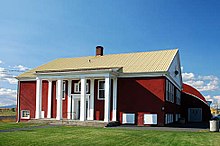
Seneca School was built in the 1930s to serve the employees of the Hines Lumber Company.