Shida Kartli
The term Kartli itself derives from Proto-Kartvelian root *kart- ("Georgian"), which is considered an ancient inner-Kartvelian formation by modern linguists.
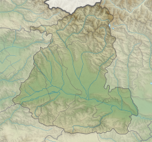
The lowest point is at 473 meter in Kaspi municipality, at the confluence of the Mtkvari and the Ksani rivers.
The highest point is the mountain Laghztsiti (3,877.4 m) which is located in occupied part of Shida Kartli.
To the north of the plain on southern slopes of the Greater Caucasus mountains (1,100–1,900 m) and to the south on northern slopes of the Trialeti range (1,400–1,900 m) climate is moderate humid with cold winters and long summers and from 1,900 m to 2,600 m with cold winters and short summers.
In the most north-western part of the region, on the western slopes of Likhi range and Racha range, a humid climate is represented with cold winters and short summers, and above 2,600 m there is a humid highland climate with a lack of true summer.
The highest average annual temperature is on the Shida Kartli plain which rises from west to east from 9 °C to 12.2 °C.
[13] In Shida Kartli the strongest winds blow in December and January, their average speed reaching 2.49 m/s and 2.35 m/s respectively.
By territorial distribution winds are especially strong on the southern slopes of the Greater Caucasus Mountains, while the weakest are on the Shida Kartli plain.