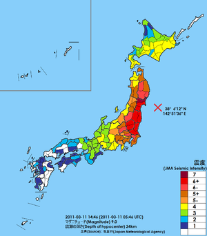
Japan Meteorological Agency seismic intensity scale
Values are derived from ground acceleration and duration of the shaking, which are themselves influenced by factors such as distance to and depth of the hypocenter (focus), local soil conditions, and nature of the geology in between, as well as the event's magnitude; every quake thus entails numerous intensities.
The agency provides authorities and the general public with real-time reports through the media and Internet giving event time, epicenter (location), magnitude, and depth followed by intensity readings at affected localities.
[9][10][11] Furthermore, the judgment for intensity 7 was based on a field survey conducted later by the JMA's mobile observation team, with specific criteria like "house collapse rate of 30% or more.
In the early years of the Heisei era, it took around 10 minutes or longer for each meteorological station to collect seismic information and issue a report along with the estimated scale.
[15] On April 1, 1996, the scale was revised, eliminating sensory-based observations and fully transitioning to instrument-based measurements.
[17][18] Furthermore, in addition to the approximately 600 JMA observation points, data from around 800 sites operated by the National Research Institute for Earth Science and Disaster Resilience (NIED) and about 2,800 local government sites were also used for JMA reports, increasing the total number of observation points to about 4,200, a significant increase from previous levels.
Since April 1997, Japan has been using specialized and automated strong ground motion accelerometers known as the "seismic intensity meter" to measure and report the strength of earthquakes based on the JMA scale.
Of these meters, around 700 are managed by the JMA, and roughly 3,700 by the National Research Institute for Earth Science and Disaster Resilience (NIED) and local government bodies.
Public institutions and transportation agencies have installed their own meters to monitor critical infrastructure such as dams, rivers, and railways.
The JMA excludes data from meters placed in unsuitable locations when assessing earthquake intensity.
Additionally, meters should be positioned far enough from nearby structures, such as trees or fences, to avoid potential impact from falling objects.
There have been instances where earthquake intensity data was used despite meters being installed in unsuitable locations, leading to questions about the accuracy of the information and subsequent corrections.
On October 29 of the same year, the Japan Meteorological Agency (JMA) concluded that the meter in Ono was improperly installed for earthquake observation.
[32] On March 7, 2013, the JMA updated its website’s color scheme for earthquake information to unify weather displays and improve accessibility for visually impaired and elderly users.
[41] The National Research Institute for Earth Science and Disaster Resilience distributes realtime instrumental seismic intensity, peak ground acceleration, velocity, displacement, and velocity response of different frequencies (0.125Hz − 4.0Hz) data across stations of its network through a web service called the Strong-motion Monitor (強震モニタ).
[42][43] The web service displays information on ongoing Earthquake Early Warning bulletins, realtime intensities at all observation points as an image, estimated epicenter location and expected propagation of P waves and S waves, along with predicted seismic intensity distribution represented as a 5km square grid.
If the intensity reaches 5− or higher, the Japan Coast Guard and Ministry of Defense carry out damage assessments.
[46] Specifically, helicopters from the regional Coast Guard offices that recorded the maximum intensity, fighter jets scrambled by Air Self-Defense Force squadrons[b], and maritime patrol aircraft deployed by the Maritime Self-Defense Force are dispatched, and the crews conduct visual inspections.
A paper by Musson et al. argues that this reliance has distanced the scale from macroseismology's original purpose: to describe human and structural impacts of earthquakes.
[51] Prior to this, Taiwan had adopted a scale identical to Japan's pre-September 1996 system, which had been established on August 1, 2000.
However, this earlier scale did not include the subdivisions of intensity levels 5 and 6 into "upper" and "lower" categories, which had been introduced later in Japan.