Sibdon Carwood
During the medieval period, the Welsh Marches was an area of instability and conflict, ruled by the Marcher lords.
The Domesday Book records Sibdon as having 6 households, making it quite a small manor population-wise.
The nearby town of Craven Arms is a relatively recent development in the area – it was established only in the mid-19th century, being at the junction of a number of newly-laid railway lines.
With much of its recent growth towards the west of the town, its urban area has reached Watling Street and its outskirts fringe into Sibdon Carwood parish.
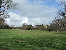
[8][9] Otherwise the hamlet consists of a farm with its own farmhouse, a small number of cottages and numerous outbuildings.
The northern border is Long Lane, with the parish of Wistanstow to the north, whilst to the west is Hopesay Hill and Common.
The parish lies on the eastern slope of the hill, between the summit and the town of Craven Arms (where the River Onny flows through); Sibdon Castle itself is at 187 metres above sea level.
A small number of holiday cottages now exist in the parish, on Long Lane and Watling Street.
[15] Long Lane is part of the "Six Castles Cycleway" and the National Cycle Network route 44.