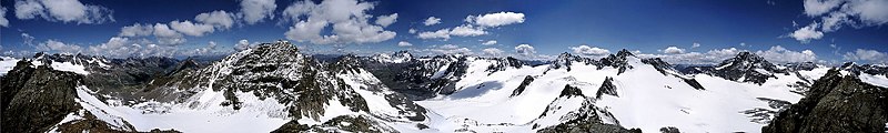
Silvretta Alps
The Austrian states of Tirol and Vorarlberg are connected by a pass road (Silvretta Hochalpenstraße at 2032 m).
According to the Alpine Clubs, the Silvretta Alps are outlined from other groups by the following borders: St. Gallenkirch - Ill river as far as Partenen - Zeinisjoch - Zeinisbach - Paznauntal as far as Ischgl - Fimbertal - Fimber Pass - Val Chöglias - Val Sinestra - Inn River from the mouth of the Branclabach to the mouth of the Susasca - Val Susasca - Flüela Pass - Davos - Wolfgang - Laretbach - Klosters - Schlappinbach - Schlappiner Joch - Valzifensbach - Gargellental - St. Gallenkirch.
The Silvretta Alps are surrounded by the Rätikon, Verwall, Samnaun, Sesvenna, Albula and Plessur ranges.
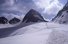
[2] It can relatively easily be ascended from north or south through glaciers and stretches of easy climbing.
In the 1920s Ernest Hemingway was staying in the region for a winter (he lived at Schruns in Montafon, Austria).