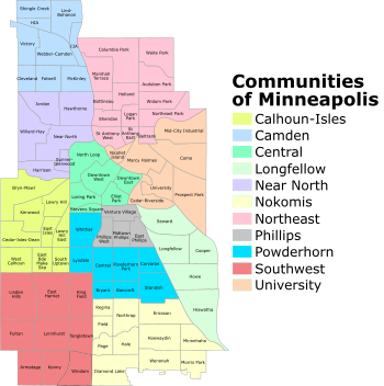
Neighborhoods of Minneapolis
Residents may also group themselves by their city street suffixes: North, Northeast, South, and Southeast.
The local community defines several general areas based on the directional suffixes added to streets in the city.
These city areas do not necessarily correlate with official community or neighborhood definitions.
The westerly portion surrounding the city's Chain of Lakes is loosely labeled Southwest Minneapolis, bounded on the east by I-35W and on the north by 36th St W, which extends west from Bde Maka Ska to the city limits.
Common conceptions of Minneapolis neighborhoods do not always align with official city maps.
Twin Cities residents and visitors frequently use generalized names based on geography, such as "North Minneapolis".
[7] In 2023, the organizations serving Beltrami and Northeast Park merged, taking the number down from 70.
It divided neighborhoods into three groups based on an evaluation of problem and need areas, then allocated funds accordingly.
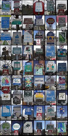
[15] Neighborhoods historically defined themselves around schools and commercial hubs, and many trace their identities to community organizations formed in the early 20th century.
The oldest, the Prospect Park Association, formed in 1901 to oppose city plans to level Tower Hill.
[18][19] Due to their location on major roads, many of these districts straddle borders between neighborhoods.
[22] The Little Earth residential area, which has been the center of the American Indian Movement, is within the community.
Eat Street is the newest of Minneapolis's commercial districts, named in the late 1990s by the Whittier Alliance to promote the international variety of restaurants along Nicollet Avenue South between Grant St. and 29th St.[25] Nicollet was historically a central commercial district in the Whittier neighborhood, but the end of the streetcar system and the construction of a K-Mart at the intersection of Nicollet and Lake Street disconnected the area in the 1970s.
Dinkytown is an area just north of the University of Minnesota within the official Marcy-Holmes neighborhood, heavily populated by students.
[31] The Warehouse District was a 19th- and early 20th-century rail and truck shipping center for the region.
In the 1970s and 1980s it became an artists' quarter, and then a nightlife and entertainment district, which the southern portion (between I-394 and Hennepin Ave) remains.
This area was central to the North Side Jewish community beginning in the early 1910s.
[34] It was designated by the city as the Homewood Historic District on February 28, 2017,[35] due to its rich Jewish history.