Southern Alps
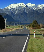
The Southern Alps (Māori: Kā Tiritiri o te Moana; officially Southern Alps / Kā Tiritiri o te Moana)[1] are a mountain range extending along much of the length of New Zealand's South Island, reaching its greatest elevations near the range's western side.
[4] They had previously been noted by Abel Tasman in 1642, whose description of the South Island's west coast is often translated as "a land uplifted high".
[5] Following the passage of the Ngāi Tahu Claims Settlement Act 1998, the official name of the range was updated to Southern Alps / Kā Tiritiri o te Moana.
New Zealand has a humid maritime, temperate climate with the Southern Alps lying perpendicular to the prevailing westerly flow of air.
Because of its orientation perpendicular to the prevailing westerly winds, the range creates excellent wave soaring conditions for glider pilots.
In 2017 a large international team of scientists reported they had discovered beneath Whataroa, a small township on the Alpine Fault, "extreme" hydrothermal activity which "could be commercially very significant".
Plants adapted to the alpine conditions include woody shrubs like Hebe, Dracophyllum, and Coprosma, the conifer snow totara (Podocarpus nivalis) and Carex sedge grasses.
There are also a number of endemic insects adapted to these high altitudes, like flies, moths, beetles, bees, and the mountain stone wētā, which can freeze solid over winter to survive the alpine conditions.