St. Matthews, Kentucky
It forms part of the Louisville Metro government but is separately incorporated as a home rule-class city.
Dating the arrival of American Indians to present-day Kentucky remains controversial, with estimates ranging from 40,000 to 10,000 years before the present.
He had conducted an important survey of the Jefferson County area in 1774, and bought 2,000 acres (8 km2) of land from Virginia and other colonial veterans who had been awarded the parcels for their service in the French and Indian War (known as the Seven Years' War in Europe).
The major crops were labor-intensive tobacco and hemp; breeding livestock, primarily horses, was also important to the economy.
The railroad did not greatly alter the economy of St. Matthews, however, which remained heavily agricultural well into the 20th century.
The area began changing in the early 20th century as a result of urban transit and automobile traffic.
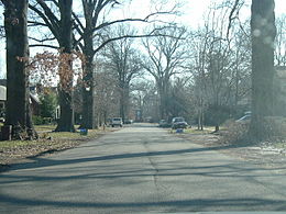
The original landowners' names – including Brown, Rudy, Nanz, Monohan, Oeschner, and Stich – were used for local streets.
A modern shopping district began developing in the 1920s, to include the landmark Vogue Theater, opened in 1938.
Growth of the area was accelerated by the Ohio River flood of 1937, which caused many families to leave low-lying ground in Louisville and move to St. Matthews.
[6] The present boundaries of St. Matthews are roughly Cannons Lane to the west, I-264 to the south and east, and several subdivisions off Brownsboro Road to the north.
Farther east, St. Matthews is bordered by Woodlawn Park, Graymoor-Devondale, Lyndon, and Norwood.
The separately incorporated cities of Richlawn, Beechwood Village and Norbourne Estates are enclaves within St. Matthews.