Subdivisions of Brazil
Since 1942, the Brazilian Institute of Geography and Statistics has divided Brazil into five geographic regions.
[1] On 23 November 1970, the regions of Brazil were adjusted slightly to the definition that is still in use today.
There are 5569 municipalities in Brazil, comprising almost the entirety of the country's territory.
The only exceptions are the Federal District (not divided into municipalities, but into 35 administrative regions, without any political autonomy) and the archipelago of Fernando de Noronha, which consists in a state district of Pernambuco.
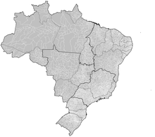
For statistical purposes, Brazilian states and the Federal District are divided into "Intermediate Geographic Regions" (Portuguese: Regiões Geográficas Intermediárias), which themselves are divided into smaller "Immediate Geographic Regions" (Regiões Geográficas Imediatas), which correspond to a metropolitan area.