Sunset Boulevard
It is a major thoroughfare in the cities of Beverly Hills and West Hollywood (including a portion known as the Sunset Strip), as well as several districts in Los Angeles.
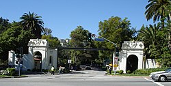
[2] From Downtown Los Angeles, the boulevard heads northwest, to Hollywood, through which it travels due west for several miles before it bends southwest towards the ocean.
In 1877, Harvey Henderson Wilcox, one of the earlier real estate owners from "back East", decided to subdivide more than 20 acres (8.1 ha) of land (mostly orchards and vineyards) along Sunset Boulevard, including what is today Hollywood and Vine.
[5][irrelevant citation] According to a 1901 article in the Los Angeles Herald, Sunset only extended from Hollywood in the west to Marion Avenue in the Echo Park district in the east.
[6] The Board of Public Works proposed to extend Sunset east to Main Street in the Plaza by routing the road over the existing section of Bellevue Avenue,[7] but the plan was delayed until approximately 1904,[8][9] due to active opposition by affected land owners.
[10] According to the 1910[11] Baist Real Estate Survey Atlas, Sunset Boulevard reached the Plaza by that time, but it did so by two short and narrow segments which were not aligned with each other and thus did not provide a proper thoroughfare to it.
This section, variously marked and signed as Marchessault Street or East Sunset Boulevard, remained open to traffic until the late 1960s or early 1970s.
[16] The westernmost stretch of Sunset Boulevard in Pacific Palisades runs through an area devastated by the January 2025 Southern California wildfires.