Surin province
Surin covers a total area of 8,854 km2 (3,419 sq mi) from the Mun River in the north to the Dangrek Mountains in the south.
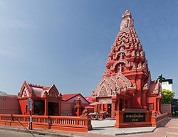
Reflecting this history as part the greater geo-cultural area of Thailand known as Isan, Surin is ethnically diverse.
Rice farmers supplement their income by cutting sugar cane, as construction laborers, or working in the local silk weaving trade.
Elephants and scenery are increasingly seen as potentially lucrative by the provincial government which has attempted to make Surin a destination for international ecotourism.
Local traders also conduct cross-border commerce with Cambodians through a border crossing at Chong Chom, 70 km south of Surin city.
[9] Surin lies at the center of the southern edge of the Khorat Plateau, a relatively low-lying interior region isolated from the rest of Southeast Asia by surrounding mountain ranges.
The south of the province is dominated by the Dongrek mountain range, the escarpment of which demarcates the watershed boundaries and also forms the international border with Cambodia.
The mountains, averaging approximately 500m in elevation, are not particularly high but the southward sides are steep cliffs rising rather abruptly from the northern plains of Cambodia significantly hindering any attempt at passing.
The Mun river valley forms the southern provincial border of this panhandle before extending somewhat diagonally northeast, opening up into a large lake near Tha Tum.
Leaving the lake, the Mun continues on to meet the provincial border with Roi Et province just west of Road 215, effectively cutting off the mainly agricultural panhandle area from the rest of Surin.
As of 26 November 2019 there are:[12] one Surin Provincial Administration Organisation (ongkan borihan suan changwat) and 28 municipal (thesaban) areas in the province.
Due to its position in the Khorat Plateau, the climate of Surin is largely affected by the surrounding mountains which block much of the rain that would otherwise be carried to the province by the monsoons.
This results in lower annual rainfall totals and greater differences between the rainy and dry seasons than areas outside the plateau.
Archaeological sites in the Khorat Plateau have provided some of the earliest evidence of pottery, metallurgy and developed wet rice cultivation in Southeast Asia.
Following the Dvaravati period, the powerful Khmer Empire expanded its influence throughout what is now the southern Isan region of Thailand.
According to legend, a local Kuay leader named Chiangpum presented a rare white elephant to Chao Phaya Chakri, the future King Rama I.
In 1763 Chiangpum's village moved 15 kilometers to its present location and was upgraded to a city named Muang Prathai Saman.
Although there was a continual influx of people from the surrounding areas, Surin was largely self-sufficient and remained somewhat isolated until the arrival of the railroad in 1922.
The culture of Surin is also strongly influenced by the Kuy people, most visibly in the activity surrounding elephants that is so prominent in the province.
The provincial seal is an image of Indra atop his celestial white elephant, Airavata which is based on the design found on a famous Khmer temple in the province.
Also spelled "Guay", "Suai" or "Kha" (pejoratively), the Kuy are a Mon-Khmer people distantly related to the Khmer and considered by many Thais to be the aboriginal inhabitants of the region.