Tamaulipan mezquital
It covers an area of 141,500 km2 (54,600 sq mi),[2] encompassing a portion of the Gulf Coastal Plain in southern Texas, northern Tamaulipas, northeastern Coahuila, and part of Nuevo León.
The region east of the Bordas Escarpment is flat with deep, sandy soils, of which vast areas both north and south of the border have been converted to agricultural use.
A series of small mountain ranges occur in the region, isolated on the coastal plain between the Sierra Madre Oriental and the Gulf of Mexico.
These ranges are not part of the strata of the Gulf Coast Plain or the complexly folded and faulted Jurassic and Cretaceous formations of the Sierra Madre Oriental.
These grasslands are banded with live oak (Quercus virginiana) groves, forming dense forest in spots, and smaller honey mesquite (Prosopis glandulosa) mottes in discontinuous belts which are sometimes connected with one another and collectively cover at least a quarter of the sand sheet.
The Laguna Madre is one of only five hypersaline coastal lagoons (or negative estuaries) in the world and a significant ecosystem in itself, laying between the Gulf of Mexico and the Tamaulipan mezquital ecoregion.
[6] As one moves inland from the hypersaline lagoon, a relatively narrow band of freshwater marshlands are encountered running north to south, albeit occurring fragmented and irregularly.
When and where present, these marshlands can be locally, surprisingly extensive with deep marshes and both permanent and ephemeral freshwater ponds that support populations of salamanders (Siren intermedia), turtles (Trachemys), and millions of migrating waterfowl, such as redheads (Aythya americana) in the winter.
Many of these river have created innumerable oxbow lakes, resacas, and abandoned channels with associated marshes and swamps as they meander across the flat coastal plain east of the Bordas Escarpment.
The few remaining riparian zones in this region that have not been cleared for agriculture, housing, and industry, can support unexpectedly lush tropical jungle vegetation, particularly in the south.
[9][10] This semi-arid region is dominated by Mezquital (Spanish for a mesquite grove[11]), thorny brush, and chaparral vegetation referred to as Tamaulipan thornscrub.
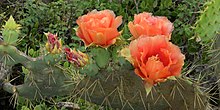
[12] Past land usage can also have a significant influence, where recently cleared areas may have a near monoculture of honey mesquite (Prosopis glandulosa), with pricklypear (Opuntia engelmannii var.
These are dominated by dense graminoids such as Texas grama (Bouteloua rigidiseta), little bluestem (Schizachyrium scoparium), sand dropseed (Sporobolus cryptandrus), and many others.
Shrub-dominated patches may develop within these grassy sites where tighter, clay soils occur, reaching six meters or higher, often dominated by several of the ubiquitous species noted above.
Canopy species include many ubiquitous trees along with huisache (Acacia farnesiana), desert hackberry (Celtis pallida), brasil (Condalia hookeri), Texas hogplum (Colubrina texensis), colima (Zanthoxylum fagara), and others.
[2][15][16] Xeric rocky uplands with shallow calcareous soils on caliche and gravel substrates support shrublands one half to two meters high.
Forbs and wildflowers can be conspicuous in rocky areas, including narrowleaf thryallis (Galphimia angustifolia), peonia (Acourtia runcinata), Gregg's senna (Chamaecrista greggii), plateau rocktrumpet (Macrosiphonia macrosiphon), and hairy zexmania (Wedelia hispida).
Lakebeds (often dry) may lack vegetation or have sparse halophytic grasses and forbs like alkali sacaton (Sporobolus airoides), sea ox-eye daisy (Borrichia frutescens), and saltwort (Batis maritima).
Soils may have a thin layer of gravel over clay with patchy grasses and cacti such as Fitch's hedgehog cactus (Echinocereus reichenbachii var.
Sometimes called potholes, lagunas, lagunitas, ponds, or copitas, these are ephemeral wetlands but may remain moist over extended periods of time.
Dominant canopy species may include many of the ubiquitous and common species noted above, as well as granjeno (Celtis ehrenbergiana), sugar hackberry (Celtis laevigata), Texas ebony (Ebenopsis ebano), anacua (Ehretia anacua), Mexican ash (Fraxinus berlandierana), tepeguaje (Leucaena pulverulenta), and cedar elm (Ulmus crassifolia).
Parque Nacional El Sabinal in the town of Ciudad Cerraivo, Nuevo Leon preserves some fine examples of old Montezuma cypress in an urban environment.
The gray wolf (Canis lupus) is extirpated and black bears (Ursus americanus) are now largely restricted to the Sierra de Picachos in Nuevo Leon, Mexico.
A few other species such as the Northern Raccoon (Procyon lotor), Coyote (Canis latrans), and to a lesser extent Bobcats (Lynx rufus) have adapted to human encroachment and development.
Other species occurring in this region include the white-tailed hawk (Buteo albicaudatus), plain chachalaca (Ortalis vetula), green parakeet (Psittacara holochlorus), buff-bellied hummingbird (Amazilia yucatanensis), Couch's kingbird (Tyrannus couchii), and Audubon's oriole (Icterus graduacauda) as well as wide-ranging tropical species such as the green jay (Cyanocorax yncas), least grebe (Tachybaptus dominicus), Ferruginous pygmy owl (Glaucidium brasilianum), ringed kingfisher (Megaceryle torquata), and the great kiskadee (Pitangus sulphuratus).
[36][37][38] Nature preserves are numerous in the region, however many are relatively small tracts of land concentrated on the north side of the Lower Rio Grande Valley.