Taungoo
Taungoo (Burmese: တောင်ငူမြို့; MLCTS: taung ngu mrui., pronounced [tàʊɰ̃ŋù mjo̰] Tauñngu myoú; S'gaw Karen: တီအူ), also spelled Toungoo and formerly Toung-ngú,[2] is a district-level city in the Bago Region of Myanmar, 220 km from Yangon, towards the north-eastern end of the division, with mountain ranges to the east and west.
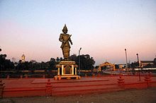
The city is famous in Burmese history for the Toungoo dynasty which ruled the country for over 200 years between the 16th and 18th centuries.
[4] Mingyi Nyo's successors Tabinshwehti and Bayinnaung went on to found the largest empire in the history of south-east Asia.
The city briefly again became capital of a rebellion in 1599 when viceroy Minye Thihathu II of Taungoo declared himself king.
In December 1599, Taungoo's forces in collaboration with the Arakanese armies aided by Portuguese mercenaries, sacked Pegu.
The rebellious city state remained independent for another 10 years when Natshinnaung ascended the Taungoo throne in 1609.
In the following year, King Anaukpetlun captured Taungoo and ended the city's long line of rulers.
[8] In 1940, the British Royal Air Force built an airfield north of the town, which from August 1941 through February 1942 served as a training and support base for the 1st American Volunteer Group, popularly known as the Flying Tigers.
[4] Three mountain ranges traverse the district—the Pegu Yomas, the Karen Hills, and the Nat Ma Taung or "Great Watershed"—all of which have a north and south direction, and are covered for the most part with dense forest.
[1] The Bamar (Burmans) make up the majority with a significant Kayin (Karen) population on the eastern side of the city.