The Description of Britain
Bertram disclosed the existence of the work through his correspondence with the antiquarian William Stukeley by 1748, provided him "a copy" which was made available in London by 1749, and published it in Latin in 1757.
The text was treated as a legitimate and major source of information on Roman Britain from the 1750s through the 19th century, when it was progressively debunked by John Hodgson, Karl Wex, B.
Charles Bertram was an English expatriate living in Copenhagen[2] who began a flattering correspondence with the antiquarian William Stukeley in 1747 and was vouched for by Hans Gram, the royal librarian to King Frederick V.[3] After a few further letters, Bertram mentioned "a manuscript in a friend's hands of Richard of Westminster,... a history of Roman Brittain... and an antient map of the island annex'd.
[10] He was excited that the text provided "more than a hundred names of cities, roads, people, and the like: which till now were absolutely unknown to us" and found it written "with great judgment, perspicuity, and conciseness, as by one that was altogether master of his subject".
Later in 1757,[b] at Stukeley's urging,[5][12] Bertram published the full text in a volume alongside Gildas's Ruin of Britain and the History of the Britons traditionally ascribed to Nennius.
It would later be determined that it was actually a clever mosaic of information gleaned from the works of Caesar, Tacitus, William Camden, John Horsley, and others, enhanced with Bertram's own fictions.
De Situ Britanniae appears among his references to sources on ancient Britain, usually cited to its emended author, Richard of Cirencester.
[16] His historical work, Military Antiquities of the Romans in Britain, relies on the forgery and is consequently deficient as a contribution to history, though his maps are still held in the highest regard.
For example, the influential and respected Barry Cunliffe's Iron Age Communities in Britain places the ancient Selgovae people far to the east of their only known location, contradicting their placement by the sole legitimate source, Ptolemy.
[17][18] This misplacement relied on William Roy's attempt to make the map of the peoples of ancient Scotland fit De Situ Britanniae.
[21] Consulting the Description, he found that it included impossible transcription errors that had been introduced to editions of Tacitus by Venetian printers in the 15th century.
[25] As part of the Rolls Series, the Historial Mirror written by the real Richard of Cirencester (his only surviving work) was closely examined over the 1860s by J.E.B.
This same document had been examined in 1749 by David Casley, the keeper of the Cotton Library,[37] and as late as 1840 Sir Frederic Madden of the manuscript department of the British Museum had not only expressed his belief in its validity but also criticised the English Historical Society for its omission of the Description of Britain in its 1838 list of important works.
Another example of the Description’s legacy were continuing references—including in the 1911 Encyclopædia Britannica—to a naval base at Dumbarton named Theodosia, long after its sole authority had been debunked.
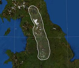
[41] In 2004, George Redmonds reassessed this, finding that numerous respected writers passed over the origin of the mountains' name in silence even in works dedicated to the topographical etymology of Derbyshire and Lancashire.
[43] In fact, the name appears at least as early as Camden as a variant of the Apennines in Italy, and Bertram was responsible (at most) with popularizing it against other contenders such as Defoe's "English Andes".