Timeline of the 1994 Pacific hurricane season

[7] Hurricane John traversed the Pacific Ocean for 8,190 miles (13,180 km), making it the farthest-traveling tropical cyclone on record worldwide.

[3] Proceeding rapidly northeastward across Mexico and into the United States after landfall, the storm and its remnants caused disastrous flooding in southeastern Texas that claimed more than twenty lives and wrought at least $700 million (1994 USD) in damage.

Heavy rainfall from One-C generated substantial flooding on the Big Island of Hawaii, resulting in damages estimated at up to $5 million (1994 USD).

[6] After weakening greatly from its peak intensity, John passed about 15 mi (30 km) to the north of Johnston Atoll as a strong Category 1 hurricane; high winds caused $15 million (1994 USD) in damage.

Figures for maximum sustained winds and position estimates are rounded to the nearest five units (knots, miles, or kilometers) and averaged over one minute, following National Hurricane Center practice.

A track map of a tropical storm over the Eastern Pacific Ocean; the storm generally moves west-northwestward
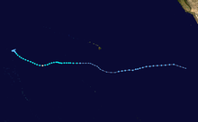
Storm path of Tropical Storm Aletta
A satellite image of a tropical storm over the Eastern Pacific Ocean
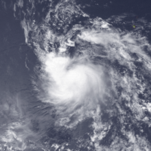
Satellite image of Tropical Storm Bud shortly after being upgraded and receiving a name late on June 27
A satellite image of a hurricane over the Eastern Pacific Ocean with a clear eye and spiral bands of thick clouds
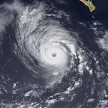
Satellite image of Hurricane Carlotta near peak intensity late on June 30
A satellite image of a tropical storm over the Eastern Pacific Ocean
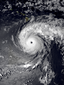
Satellite image of Tropical Storm Daniel near peak intensity late on July 10
A track map of the west-northwestward path of a hurricane over the Eastern and Central Pacific Ocean
Storm path of Hurricane Emilia
A close-up satellite image of a powerful hurricane's eye with smaller cloud swirls inside
The eye of Hurricane Emilia as seen from satellite on July 19, with mesovortices visible
A track map of the westward path of a tropical storm over the Eastern and Central Pacific Ocean
Storm path of Tropical Storm Fabio
A satellite image of a powerful hurricane over the Central Pacific Ocean; it has a circular eye, a thick and round central region of clouds, and pronounced spiral bands on its eastern flank
Satellite image of Hurricane Gilma at peak intensity late on July 24
A track map of a tropical cyclone that traversed a portion of the Eastern and Central Pacific Ocean as a tropical depression; it eventually became a minimal hurricane for a brief period of time, just before it crossed the International Date Line. Though it has several dips and rises, the system's track generally represents a westward trajectory overall.
Storm path of Hurricane Li, including the time it spent west of the International Date Line from August 12 to August 18 [ nb 6 ]
A satellite image of a tropical storm off the west coast of the southern Baja California peninsula
Satellite image of Tropical Storm Hector just after peak intensity late on August 8
A track map of the westward path of a tropical depression over the Central Pacific Ocean, just south of Hawaii
Storm path of Tropical Depression One-C
A satellite image of a hurricane with a ragged and cloudy eye just southwest of the southern tip of the Baja California peninsula
Satellite image of Hurricane Ileana at peak intensity late on August 12
A track map of a tropical depression over the Eastern Pacific Ocean, off the west coast of the Baja California peninsula. The system's path starts with a slow north-northeastward motion; as it accelerates, the system gradually turns to the west, which results in the overall track resembling a fish hook.
Storm path of Tropical Depression Twelve-E
A satellite image of a powerful hurricane south of the Big Island of Hawaii. It has a clear and well-defined eye surrounded by a circular area of intense convection; a pronounced outer band originates from the western side of the storm and curves clockwise a quarter of the way around it, before jutting out to the east.
Satellite image of Hurricane John near peak intensity south of Hawaii early on August 23
A satellite image of a hurricane over the Central Pacific Ocean. It has a clear but ragged eye surrounded by deep but somewhat lopsided convection which is mostly concentrated in the northeastern quadrant; an arc of thin high clouds begins on the system's south side, curving around the western flank.
Satellite image of Hurricane Kristy near peak intensity late on August 31
A satellite image of a powerful hurricane over the Eastern Pacific Ocean, with a cloudy but well-defined eye, a central region of deep convection marked by thick clouds, and several spiral bands; a large arc of thin high clouds is fanning out to the northwest of the hurricane
Satellite image of Hurricane Lane near peak intensity late on September 6
A satellite image of a tropical depression on the cusp of becoming a tropical storm over the Central Pacific Ocean
Satellite image of Tropical Depression Two-C late on September 6, shortly before the system became a tropical storm and received the name Mele
A track map of a hurricane over much of the Pacific Ocean. It is generally westward at first, except for two brief northwest turns early in the system's life. It then gradually curves into a more prolonged northwestward motion, which ends with an abrupt turn to the east as it slows down greatly. A hairpin turn results in the system resuming a northwestward trajectory; finally, it turns northeastward and accelerates, meeting its demise over the far northern Central Pacific basin.
Storm path of Hurricane John , including the time it spent west of the International Date Line from August 28 to September 8
A track map of a tropical storm over the Eastern Pacific Ocean; the system initially moves west-northwestward before turning to the west-southwest midway through its life
Storm path of Tropical Storm Miriam
A track map of a tropical storm over the Eastern Pacific Ocean, off the west coast of Mexico; the system initially moves northwestward at a brisk pace, slowing down and turning northward later in its life
Storm path of Tropical Storm Norman
A satellite image of a powerful hurricane over the Eastern Pacific Ocean; it has a well-defined eye surrounded by thick, intense convection, with pronounced spiral bands extending southward from the storm and multiple arcs of thin high clouds fanning out to the northwest
Satellite image of Hurricane Olivia near peak intensity on September 25
A satellite image of a minimal tropical storm over the Eastern Pacific Ocean
Satellite image of Tropical Storm Paul just prior to peak intensity late on September 26
A satellite image of a hurricane approaching the west coast of Mexico; its eye is surrounded by convection spiraling inwards, and there is a large region of clouds fanning out to the north
Satellite image of a strengthening Hurricane Rosa approaching the Mexican coast on October 13
A satellite image of a tropical depression over the Central Pacific Ocean
Satellite image of Tropical Depression Three-C , which later became a tropical storm and received the name Nona , on October 22