The season officially started on May 15, 1997, in the Eastern Pacific—designated as the area east of 140°W—and on June 1, 1997, in the Central Pacific, which is between the International Date Line and 140°W.
These dates typically limit the period of each year when most tropical cyclones form in the eastern Pacific basin.
This timeline documents all the storm formations, strengthening, weakening, landfalls, extratropical transitions, as well as dissipation.
Of these, 19 were in the east Pacific; 8 peaked at tropical storm intensity, while 10 reached hurricane status.
The 1997 season was the fourth-most active in the Central Pacific since satellite observations began.
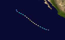
The track of Tropical Storm Andres
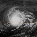
Tropical Storm Blanca at peak intensity off Mexico
Track of Tropical Storm Carlos
Hurricane Dolores at peak intensity
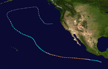
Hurricane Enrique's track
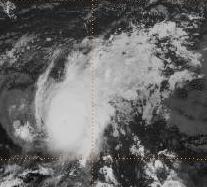
Hurricane Felicia at peak strength
Track map of Hurricane Guillermo, the first Category 5 hurricane of the season
Image of Tropical Storm Hilda at peak strength
Track of Tropical Storm Ignacio
Hurricane Jimena at peak strength
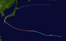
Track of Tropical Storm/Super Typhoon Oliwa
Image of Tropical Storm Kevin at peak strength
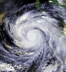
Hurricane Linda at record breaking intensity
Track of Tropical Storm Marty
Hurricane Nora just after peak intensity
Tropical Storm Olaf's track
Hurricane Pauline at peak intensity just offshore of Mexico on October 8, 1997
Hurricane Rick at landfall in Mexico at Category 1 hurricane strength