Timeline of the 2018 Pacific hurricane season

The season officially started on May 15 in the eastern Pacific—east of 140°W—and began on June 1 in the central Pacific—the region between the International Date Line and 140°W, and ended on November 30.

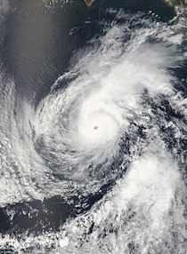
The 2018 hurricane season was exceptionally active and featured the highest Accumulated Cyclone Energy since reliable records began in 1971.

[3][nb 1] The basin saw above-average activity across all regions from the International Date Line to the west coast of Mexico and Central America.

Instead, low pressures and increased sea surface temperatures associated with the Pacific Meridional Mode supported the development of these intense and long-lived storms.

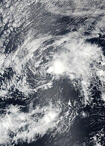
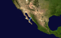
This timeline documents the formation of tropical cyclones as well as the strengthening, weakening, landfalls, extratropical transitions, and dissipations during the season.

Satellite image of Tropical Depression One-E several hours after being classified as a tropical cyclone on May 10
Tropical Depression One-E several hours after being classified as a tropical cyclone on May 10
Satellite image of Aletta as a Category 4 hurricane on June 8
Aletta as a Category 4 hurricane on June 8
Satellite image of Hurricane Bud strengthening off the southwestern Mexican coast on June 11
Hurricane Bud intensifying off the coast of Mexico on June 11
Satellite image of Tropical Storm Carlotta paralleling the southern coast of Mexico on June 16
Tropical Storm Carlotta paralleling the coast of Mexico on June 16
Satellite image of Tropical Storm Daniel at peak intensity on June 24
Tropical Storm Daniel on June 24 at peak intensity
Satellite image of Hurricane Fabio peaking at Category 2 intensity on July 3
Hurricane Fabio near peak intensity on July 3
Track map of Tropical Storm Gilma's path across the Eastern Pacific Ocean from July 26–29
Tropical Storm Gilma's path across the Eastern Pacific Ocean from July 26–29
Satellite image of Tropical Storm Ileana near peak intensity off the western coast of Mexico on August 5
Tropical Storm Ileana near peak intensity off the western coast of Mexico on August 5
Satellite image of Hector as a high-end Category 4 hurricane on August 6
Hector as a high-end Category 4 hurricane on August 6
Satellite image of Hurricane Lane at Category 5 intensity on August 22
Hurricane Lane at Category 5 intensity early on August 22
Satellite image of Hurricane Norman peaking as a Category 4 hurricane on August 30
Hurricane Norman peaking as a Category 4 hurricane on August 30
Satellite image of the unclassified tropical or subtropical cyclone near the International Dateline on September 2
The unclassified tropical or subtropical cyclone near the International Dateline on September 2
Satellite image of Hurricane Olivia as a high-end Category 3 hurricane on September 6
Hurricane Olivia as a high-end Category 3 hurricane on September 6
Animated infrared satellite imagery of Tropical Storm Olivia making landfalls on Maui and Lanai, Hawaii, on September 12
Track map plotting the path of Tropical Depression Nineteen-E across the Gulf of California from September 19–20
Path of Tropical Depression Nineteen-E across the Gulf of California from September 19–20
Satellite image of Hurricane Rosa as a Category 4 hurricane on September 28
Hurricane Rosa as a Category 4 hurricane on September 28
Satellite image of Hurricane Walaka at Category 5 intensity
Hurricane Walaka at Category 5 intensity while southwest of the Hawaiian Islands
Track map plotting the path of Hurricane Sergio across the Eastern Pacific Ocean from September 29 – October 12
Path of Hurricane Sergio across the Eastern Pacific Ocean from September 29 – October 12
Satellite image of Hurricane Willa as a Category 5 hurricane, southwest of Mexico
Hurricane Willa at its peak intensity on October 22 just southwest of Mexico
Satellite image of Tropical Storm Xavier at its peak intensity near western Mexico on November 4
Tropical Storm Xavier at its peak intensity near western Mexico on November 4