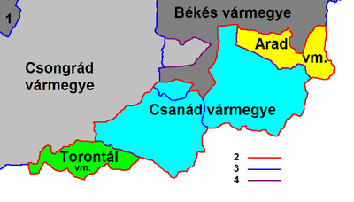
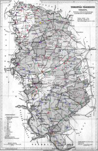
Torontál County
The capital of the county was Nagybecskerek (Serbian: Велики Бечкерек, German: Großbetschkerek, Romanian: Becicherecu Mare), the current Zrenjanin.
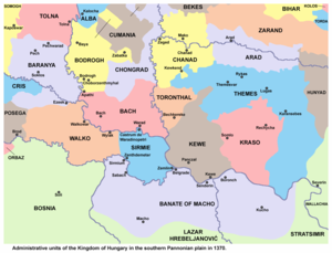
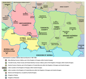
From its recreation in 1779 until its partition in 1920 it shared borders with the Hungarian counties of Bács-Bodrog, Csongrád, Csanád, Arad and Temes.
In 1848/1849 the area of the county was claimed by the self-proclaimed Serbian Voivodship, while between 1849 and 1860 it was part of the Voivodeship of Serbia and Banat of Temeschwar, a separate Austrian crownland.
In 1876, when the administrative structure of the Kingdom of Hungary was changed, the borders of Torontal County were modified to include the District of Velika Kikinda.
A few years prior, parts of the territory of the former Banat Military Frontier (including Pancsova/Pančevo, formerly the seat of the so-called German Regiment) had also been annexed to it.