Townlands of Kilcommon
Aughoose (Irish: Na hEachú[1]) is on the Dún Chiortáin peninsula overlooking the lower reaches of Sruwaddacon Bay (Sruth Fada Conn), and has an area of 898 acres (3.63 km2).
[citation needed] Barnatra (Irish: Barr na Trá[2]) straddles the parishes of Kilcommon and Kilmore at the lower end of Broadhaven Bay.
Bellanaboy (Irish: Béal an Átha Buí[3]) covers an area of 1,050 acres (4.2 km2), most of which is now enclosed around a fossil-fuel refinery under heavy security which has been built by Royal Dutch Shell on government, Coillte-controlled conifer plantation land.
Cill Ghallagáin[6] (English: Kilgalligan) is on the northern tip of the Dun Chiortáin peninsula, and a small village bears its name.
The Gweedaney River rises at Portacloy and flows past the old chapel in the dunes into Sruwaddacon Bay; the modern church is farther inland.
Glenamoy (Irish: Gleann na Muaidhe[10]) is the general name for nine Kilcommon townlands: Bellagelly North and South, Baralty, Bunalty, Gortleatilla, Srahnaplaia, Pollboy, Lenarevagh and Barroosky.
Gortbrack (Irish: An Gort Breac[14]), occupying a large section of the south side of the western peninsula, covers an area of 1,070 acres (4.3 km2) in size.
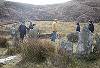
The Owenduff River flows through the townland, which is of archaeological interest due to its location along the southern coastal slopes and its numerous Neolithic megaliths.
Gortmelia (Irish: Gort Meille[15]), on the west side of the Dún Chiortáin peninsula overlooking Inver Bay, covers an area of 1,237 acres (5.01 km2).
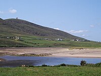
Inver (Irish: An tInbhear[16]), covering an area of 663 acres (2.68 km2), is on the western side of the Dún Chiortán peninsula overlooking Trá Kirtaan (Chiortáin's Beach).
On the Dún Chiortáin peninsula and also known as Poll a tSómais,[20] Pollatomais, Kilcommon, Pullathomas (the most common spelling) and Pollatomish, Pollathomas covers an area of 673 acres (2.72 km2).
During that famine, residents ate seaweed and seagull eggs;[22] landlord James O'Donel was attacked at a local lodge, and trained crows to protect his property.
[23] Portacloy (Irish: Port an Chlóidh[24] on the north of the Dún Chaocháin peninsula, covers an area of 922 acres (3.73 km2) on the western boundary of Porturlin.
During the Great Famine, Richard Webb (who was bringing relief from the Society of Friends) called it the finest fishing grounds in Mayo but added: "The only access by land is over a high and boggy mountain, so wet and swampy that it is difficult to reach it even in summer.
[26] When William Bald improved the Erris area in 1835, he recommended building piers in Porturlin and Portacloy to aid local fishermen.
In June 2009, fisherman Pat O'Donnell reported that his boat was sunk by armed men allegedly connected to the Corrib gas project.
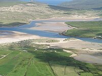
The tides of Sruwaddacon Bay are hazardous, as described in a song lyric: The Rossport Ferry and its rapid current The second strongest that our State possesses[citation needed] The townland has been the scene of protests against the Corrib gas project.
[citation needed] Srahataggle (Irish: Sraith an tSeagail[29]), covering an area of 4,167 acres (16.86 km2), is a remote village; in 2004, a road connecting it to Belderrig was tarred for the first time.
The Western People reported during the early 1950s, "Remote as these habitations may appear to many, there is no lack of worldly knowledge and cultural attainments and many of their sons and daughters have risen to important posts in countries beyond the seas".