Transportation in Indianapolis
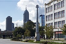
[3] The prospects of river navigation coupled with a site near the center of the state were largely responsible for the location of Indianapolis.
Flatboats continued to transport goods along a portion of the river until new dams impeded their ability to navigate its waters.
[9] Public transit arrived in Indianapolis on October 3, 1864, in the form of 12-seat mule-drawn streetcars which began operating between Union Station and Military Park.
Citizens Street Railway Company managed several streetcar lines running on a hub-and-spoke system radiating from downtown Indianapolis to outlying neighborhoods.
[12][8] Electrification of the city's streetcar system dramatically improved efficiency and expediency, allowing residents to live further from the civic and business center of downtown.
At the time of its opening in 1888, Indianapolis Union Station was servicing 80 passenger trains per day from 16 different railroad companies.
[8] As the city's population grew and rail traffic increased, congestion at numerous level crossings became a major concern.
[8] Some of the first aircraft to take flight in the city occurred at the Indianapolis Motor Speedway during the first licensed aviation meet in the U.S. and first public demonstration of airplanes in Indiana, from June 13–18, 1910.
[22] Cox Field was the city's first municipal airport, serving as the site of Indianapolis's first regularly scheduled commercial flight, on December 17, 1927.
[17] Like most American cities following World War II, Indianapolis's electric streetcar ridership declined as personal automobile ownership increased.
In 1952, more than 400 public transit vehicles traveled more than 43,000 miles (69,000 km) daily, providing 72 million passenger trips annually.
[25] In 1961, the Indiana General Assembly approved legislation allowing for the creation of a local administrative body to oversee air transportation throughout the region.
[26] Numerous expansions have occurred since Indianapolis International Airport opened in 1931, the most recent completed in 2008 at a cost of US$1.1 billion.
The Federal Aviation Administration (FAA) National Plan of Integrated Airport Systems for 2017–2021 categorized it as a medium hub primary commercial service facility.
[32] The Colonel H. Weir Cook Terminal contains two concourses and 40 gates, connecting to 51 nonstop domestic and international destinations and averaging 145 daily departures.
It ranks among the ten busiest airports in terms of cargo throughput in the U.S.[34] The Indianapolis Airport Authority owns and operates an additional five aviation facilities in the city and surrounding counties:[31] Four other publicly owned general aviation airports are located elsewhere in the Indianapolis metropolitan area: Intercity bus service to Indianapolis is provided by Barons Bus Lines, Burlington Trailways, FlixBus, Greyhound Lines, and Miller Transportation, among other private carriers.
In 2021, Indianapolis Union Station was the state's primary intercity bus transfer hub, served by seven carriers operating 12 routes.
Indianapolis is a hub for CSX Transportation, home to its division headquarters, an intermodal terminal, and classification yard in the suburb of Avon.
[41] The Indianapolis metropolitan area is served by four primary and two auxiliary freeways that are part of the Interstate Highway System.
[42][43][44] The North Split interchange—where the two highways merge northeast of the central business district—is the second-busiest interchange in Indiana, with traffic counts of more than 200,000 vehicles per day.
[2] In recent years, officials have committed to increased funding for bicycling infrastructure upgrades and additions, including the city's first neighborways.
Indiana Pacers Bikeshare debuted in 2014 as the city's public bicycle-sharing system, consisting of 525 bicycles and 50 docking stations.
[58][1] In 2017, City-County Council approved a voter referendum increasing Marion County's income tax to help fund IndyGo's first major system expansion since its founding.
[62] CIRTA serves ten counties, including Boone, Delaware, Hamilton, Hancock, Hendricks, Johnson, Madison, Marion, Morgan, and Shelby.
[63] The first of IndyGo's three bus rapid transit (BRT) projects, the Red Line, began service on September 1, 2019.
[57] The 15.2-mile (24.5 km) Purple Line, the system's second BRT service, opened in October 2024, connecting downtown Indianapolis to the city of Lawrence.
[66] The third and final route, the Blue Line, is planned to run 24 miles (39 km) east–west from the town of Cumberland to the Indianapolis International Airport.
[70][69] After three years of study, the group proposed a 2-mile (3.2 km) streetcar circulator linking key attractions on the west side of downtown Indianapolis at an estimated cost of $20 to $25 million.
[73] In 2014, the Indiana General Assembly granted Indianapolis and five neighboring counties the authority to raise local income taxes to fund public transit by referendum.
[74] As part of a legislative compromise, the bill included a provision prohibiting local governments from publicly financing light rail projects.


ǁ Interstate ‖ U.S. Highway or Indiana State Road ‖ Decommissioned