Transportation in Kern County, California
Kern County’s transportation system was quoted as the “unseen industry.”[1] Located at the southern end of the San Joaquin Valley, the county is at a prime location to ship goods west to the central coast, south to ports in Los Angeles, and east to corridors that connect to the rest of the country.
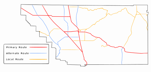
They are listed below, with the names either officially designated by the state, or commonly used by local authorities and Caltrans.
They primarily connect local roads and rural communities to primary and alternate routes.
Currently Caltrans and the Federal Highway Administration are negotiating what needs to be upgraded to conform to interstate standards.
In Kern County, The Mojave Freeway name is used by local authorities and Caltrans to refer to SR 58 between Bakersfield and Barstow.
[6] The California Legislator gave the same name to the Barstow Freeway (I-15) between San Bernardino and the Nevada state line.
[10] Regional service is provided by the San Joaquin Valley Railroad, which was purchased by RailAmerica.
[11] At one time, a railroad line connected Bakersfield and the oil rich City of Taft, known as the Sunset Railway.
Passenger service is provided exclusively by the San Joaquin Route, run by Amtrak California.
[12] High level of demand through the Tehachapi Pass has prevented any rail service from extending south of Bakersfield.
This proposes to link Los Angeles with San Francisco and Sacramento by a high speed train.
Bakersfield is the location of the station within Kern County, and will serve the southern San Joaquin Valley region.
Several industrial complexes are located around the airport for easy transportation of goods from warehouses to airplanes.
Originally flights were flown between Bakersfield and Mexico; however, the terminal closed when the air carrier discontinued service.
[19][20] Another private bus carrier is Airport Valet Express, located at Stockdale Hwy.
It provides direct service to and from Bakersfield and all terminals at Los Angeles International Airport (LAX).
Similar to the county, the city also has a transportation network to facilitate the movement of goods both through and terminating in it.
However, the Westside Parkway is currently being constructed parallel to Stockdale Highway and the Kern River as a local freeway (built to Caltrans standards).
Additional right of way was reserved to extend the freeway east to SR 178, but there are currently no plans for construction.
The Southern Pacific station was located at the intersection of Sumner and Baker streets in East Bakersfield.
In East Bakersfield, since the streets were laid out by Southern Pacific, they ran parallel to their railroad tracks, which is about 45 degrees off from the rest of the city.
[1] Public transportation in the Greater Bakersfield area is provided exclusively by Golden Empire Transit.
However, unlike Kern Regional Transit, direct transportation to the Amtrak station is not provided.
It is located in the Kern River Parkway and runs from China Grade Loop (west of Hart Park) to Enos Lane (east of I-5).
The Kern Island Canal, which runs through eastern downtown, was modified to resemble a natural creek.
Most new developments, primarily in the northwest and southwest, have created shaded, winding sidewalks adjacent to arterials.
SR 65, the shortest highway to be converted within Kern County, is not scheduled to start construction on its first segment until at least 2025.
[28] In addition, Kern County has proposed constructing an intermodal facility near Meadows Field.
The location is close to air with Meadows Field, rail with Union Pacific mainline, and road with State Route 99.
It would travel on surface streets, and run through many populated parts of the city, including: southwest, downtown, east Bakersfield, and northeast.