Thiruvananthapuram district
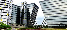
The city of Thiruvananthapuram is also known as the Information technology capital of the State, since it is home to the first and largest IT park in India, Technopark, established in 1990.
The urban bodies in the district are the Thiruvananthapuram Corporation, and the Varkala, Neyyattinkara, Attingal, and Nedumangad municipalities.
The district's official name in English was Trivandrum until 1991, when the government reinstated the city's original name, Thiruvananthapuram, in all languages.
The Chera dynasty governed the area of Malabar Coast between Kanyakumari in the south to Kasaragod in the north.
The region around Coimbatore served as the eastern entrance to the Palakkad Gap, the mountain pass that is the principal trade route between the Malabar Coast and Tamil Nadu.
[15] The southernmost region of present-day Malabar coast (the coastal belt between Kanyakumari and Kollam) was ruled by the Ay dynasty, who were related to, and officially feudatories of the Cheras.
[22] Later it became a part of Venad in late Middle Ages, which was eventually expanded as the powerful kingdom of Travancore in 18th century CE.
[22] In 1684, during the regency of Umayamma Rani, the English East India Company acquired a sandy spit of land at Anchuthengu, near Varkala on the sea coast about 32 kilometres (20 mi) north of Thiruvananthapuram city, with a view to erecting a factory and fortifying it.
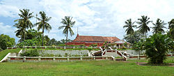
In addition to the presiding deity of Padmanabha, this temple contains several shrines, dedicated to Krishna, Narasimha, Ganesha, and Ayyappa.
In 1740 when an allied force,[34] led by Dutchman Captain Hockert supporting the Deshinganadu King, attacked Venad, an army from Kilimanoor resisted and then defeated them.
In 1753, in recognition of this feat, Marthanda Varma exempted the areas controlled by the Kilimanoor palace[35] from taxes, and granted them autonomous status.
[citation needed] Velu Thampi Dalawa held meetings at Kilimanoor palace while planning uprisings against the British.
The southernmost part of the city, Parassala, is just 54 kilometres (34 mi) away from the southern peninsular tip of India, Cape Comorin (Kanyakumari).
As the district stretches from north to south, with the Arabian Sea to the west, the relative humidity is generally high.
[40] The southwest monsoon, from June to September is the principal rainy season, during which the district receives most of its annual rainfall.
As of 31 March 2003, Kerala State Industrial Development Corporation (KSIDC) units employed 9,262 people, and had invested Rs.
Institute) in Thiruvananthapuram city is a major state government emporium marketing products of Kerala's handicraft industries.
[47] Thiruvananthapuram district sees a dynamic political landscape with major alliances led by the Communist Party of India (Marxist) and the Indian National Congress.
In the 2021 Assembly Election, the Left Democratic Front (LDF) secured an impressive victory by winning 13 out of the total 14 seats in the Thiruvananthapuram district.
[52] The Main Central Road covers a distance of 55 km (34 mi), passing through Kesavadasapuram, Vembayam, Venjaramoodu, Kilimanoor, and Nilamel in the north.
Thiruvananthapuram city is more cosmopolitan, with speakers of languages including Malayalam, Tamil, English, Telugu, Hindi, Tulu and a small percentage of Marathi.
Aromatic plants and spices, such as pepper and ginger, are cultivated on a large scale on the hilly tracts.
A major portion of the district lies on the middle plain, where coconut, rice, tapioca, tuber crops, plantains, and vegetables are cultivated.
[62] The forests of the district abound in a variety of animals and birds, providing excellent wildlife habitats.
Nestled in the Western Ghats, a wildlife sanctuary extends over an area of nearly 777 square kilometres (300 sq mi) around the Neyyar reservoir.
A full range of tourist options is available in the district, including hill stations, the Kerala backwaters, beaches, lagoons, and wildlife sanctuaries.
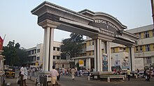
Thiruvananthapuram is a major destination for chartered flights to India for medical tourism, with over fifty recognized Ayurveda centres in and around the city.
Now, more than 30 newspapers have been published from the district, including The Hindu, The New Indian Express, The Deccan Chronicle, The Times of India, Malayala Manorama, Mathrubhoomi, Kerala Kaumudi, Desabhimani, Deepika, Madhyamam, Chandrika, Thejas, Siraj, Janmabhoomi and Metro Vaartha.
The main GSM networks operating in the district are BSNL CellOne, Airtel, Tata Docomo, Idea Cellular, Vodafone, Reliance, and Virgin Mobile.
Major broadband internet services are provided by BSNL DataOne, Asianet Dataline, and Siti Cable.