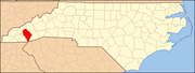
Tuckasegee, North Carolina
It followed the earlier Cherokee town as developing on the upper Tuckaseegee River, at the confluence of its East and West forks.
This area was part of the Cherokee homelands and had been inhabited for thousands of years by ancestral indigenous peoples.
[5] The historic Cherokee town of Tuckasegee was shown on George Hunter's Map of 1730, prepared when he was Surveyor General of South Carolina.
The Rutherford Light horse expedition had forces that attacked Cherokee towns on both sides of the mountains, because they had allied with the British.
The European-American community of Tuckasegee has historically been flood-prone because of its location at the confluence of forks of the river.
Since the 1930s, dams have been built on upper portions of each fork of the river to provide flood control.