U.S. Route 20
On the way it goes over the Central Oregon Coast Range, through several Willamette Valley cities including Corvallis and Albany, climbs the Cascade Mountains over Santiam Pass, goes through Bend, and traverses the Oregon High Desert after passing through Burns.
It eventually overlaps US 26 in Vale, and the two highways continue concurrently to the Idaho border.
These four highways parallel each other (on two roadways) to Boise where US 20/US 26 runs through downtown before joining with I-84 and US 30 again to Mountain Home, where it departs at exit 95 to head east, past Rattlesnake Station, Anderson Ranch Dam road, and cresting at Cat Creek summit at 5,527 feet (1,685 m) above mean sea level.
US 20 continues east through Picabo and Carey, joined with US 26 and US 93, to Craters of the Moon and Arco, where US 93 splits off and turns north-northwest to climb the Big Lost River valley.
Throughout its 431.60-mile (694.59 km) length the route passes through a diverse range of landscapes including bluffs and escarpments in the Northwest Panhandle, the Nebraska Sandhills in the northern part of the state, and rolling hills and plains through Randolph, Nebraska as the highway approaches the Missouri River valley south of Sioux City, Iowa.
After skirting the southeast side of Sioux City as a freeway with US 75, US 20 continues east as an expressway to Moville.
This segment re-opened October 19, 2018 and made it so that US 20 is a continuous four-lane highway for its entire length in Iowa.
In the Waterloo/Cedar Falls area, the segment of US 20 overlapped by the Avenue of the Saints, which is also designated as Iowa Highway 27.
The road continues as a bypass north of Freeport, and then runs as a freeway along the southern fringe of Rockford.
It then parallels US 12 to just west of Michigan City before running due east through New Carlisle to South Bend.
Today, there are numerous communities along US 20 and the lakefront, including Gary, Portage, Burns Harbor, Porter, Chesterton, Pines, and Michigan City.
Most notably, the route is one of the main access roads to Indiana Dunes National Park.
US 20 enters Ohio from Indiana just west of Columbia and traverses east through Pioneer and Alvordton to Fayette.
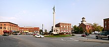
Continuing east, US 20 traverses through Elyria, North Ridgeville, Westlake, Rocky River, Lakewood and Cleveland, where it goes right through Public Square.
East of Cleveland US 20 follows the southern shore of Lake Erie, following Euclid Avenue from Public Square, and traverses Euclid, Wickliffe, where it intersects with I-90, Mentor, Painesville, Madison, Geneva, Ashtabula and crosses into Pennsylvania at Conneaut.
US 20 runs for nearly 50 miles (80 km) across Erie County, Pennsylvania, most of that time just south of the CSX/Amtrak railroad tracks.
US 20 appears as West Ridge Road eastward from the Ohio border through Springfield, Girard, Fairview and Millcreek townships.
Outside the town limits it becomes East Main Road until it reaches Pennsylvania's border with New York.
The route runs concurrently with New York State Route 5 twice, with the second overlap extending 68 miles (109 km) across Western and Central New York from Avon to Auburn running along the top of the Finger Lakes crossing Canandaigua and Seneca Falls along the way.
Southwest Cutoff was created at the turn of the century to bypass truck traffic around Shrewsbury center as well as connecting to the Boston and Worcester Turnpike.
In 1926, after engineers determined that heavy truck traffic on the Boston Post Road was damaging the foundations of the Inn, Henry Ford, then owner and proprietor, ordered the construction of the mile-and-a-half-long Route 20 bypass.
The St. Joseph Valley Parkway is the present route of US 20 in the South Bend – Elkhart Area.
US 20 now crosses from West Springfield at the North End Bridge, and is co-signed with I-291 until Page Boulevard, where it heads back to Boston Road via the former route of 20A.