U.S. Route 56
The eastbound shoulder also touches a corner of Texas at a small road junction near the New Mexico/Oklahoma border.
The two routes begin in Springer and head east towards Abbot, where they serve as the northern terminus of State Road 39.
The three routes serve as the southern terminus of NM 406 as they enter the Kiowa National Grassland.
It joins with I-35/US-50 east of Gardner, and goes northeast with I-35 into the Kansas City Metro Area.
In the early 1950s, towns along what was then the K-45 corridor, connecting Ellsworth, Kansas to the Oklahoma state line at Elkhart, formed the Mid-Continent Diagonal Highway Association[3] to push for a new highway from Springer, New Mexico (on US 85) northeast across the Oklahoma Panhandle, along K-45, and continuing to Manitowoc, Wisconsin on Lake Michigan.
[5] The first submissions to the American Association of State Highway Officials (AASHO) to establish the route were made in 1954; all placed the northeast end at Manitowoc, Wisconsin (absorbing US 151 from Cedar Rapids, Iowa[citation needed]), while they varied on whether the southwest end was to be at Albuquerque, New Mexico or Nogales, Arizona.
[6] The first route considered in northeast Kansas was via US 40 from Ellsworth to Topeka and K-4 and US 59 via Atchison to St. Joseph, Missouri.
[8] In July, the US 50-N Association proposed a plan that would have eliminated US 50N by routing US 55 along most of its length, from Larned east to Baldwin Junction, and then along US 59 to Lawrence and K-10 to Kansas City; towns on US 50N west of Larned, which would have been bypassed, led a successful fight against this.
[11] On June 27, 1956, the AASHO Route Numbering Committee considered this refined plan for US 55, between Springer, New Mexico and Kansas City, Missouri, with a short US 155 along the remaining portion of US 50N from Larned west to Garden City.
[6] On June 26, 1958, AASHO denied the New Mexico Department of Transportation's request to extend US 56 west from Springer to Santa Fe, which would have followed US 85, US 84 and US 285.
heads north through flat lands with scattered trees for 1.1 miles (1.8 km) then enters Herington.
The highway continues for roughly 0.55 miles (0.89 km) then curves east and becomes Trapp Street.
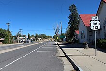
After roughly 0.85 miles (1.37 km) the highway exits the city and reaches its eastern terminus at US-56 and US-77.
was approved to be decommissioned in a meeting on June 9, 1991, leaving just US-56 Bus..[18] The entire route is in Dickinson County.