K-156 (Kansas highway)
Along the way, it intersects several major highways including US-50, US-83 and US-400 in Garden City; US-283 in Jetmore; and US-183 near Rozel, and it overlaps its implied parent, US-56, from Larned to east of Great Bend.
[3][4] The section of K-156 from the western end of the overlap with US-56 to its eastern terminus is included in the National Highway System.
From here, the highway continues east for about eleven miles (18 km) through rural farmlands before intersecting K-23, passing by Concannon State Fishing Lake and crossing Pawnee River along the way.
As it passes by Hanston, K-156 curves east briefly then back northeast as it begins to parallel a Kansas and Oklahoma Railroad track.
[14][15] As it enters the county it continues to parallel a Kansas and Oklahoma Railroad track and the Pawnee River.
After about 1.4 miles (2.3 km) K-156 curves east, passes to the north of Rucker Airport, then enters the southern section of Burdett as Broadway Avenue.
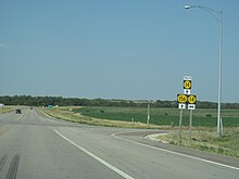
[16] It exits the city and continues east, crosses Sawmill Creek, then reaches an intersection with Pawnee Street and 280th Avenue just south of Rozel.
From here the highway continues east through rural farmlands to US-183, crossing the Pawnee River and Cocklebur Creek along the way.
It continues east for about nine miles (14 km) before intersecting K-264, passing Fort Larned National Historic Site along the way.
The two routes curve northeast as they exit the city and begin to parallel a Kansas and Oklahoma Railroad track.
After the three highways cross US-281, they leave Great Bend and 2.2 miles (3.5 km) later, K-156 splits from US-56 and K-96, heading northeast from there.
[22] As it exits the city, it continues through rural farm lands transitioning into grasslands, and soon intersects K-14 south of Ellsworth.
The two routes then cross the Smoky Hill River and a Union Pacific Railroad track then enter Ellsworth.
The highway passes Memorial Cemetery and soon intersects K-140, known as East 15th Street westbound and Avenue J eastbound.
The highway soon exits the city and continues north for about .8 miles (1.3 km) then curves northeast and crosses Oak Creek.
It continues north along the creek for a few miles before reaching its northern terminus at exit 225 of I-70 and US-40 at a diamond interchange.
[28][29] In the early 1950s, towns along what was then the K-45 corridor, connecting Ellsworth, Kansas to the Oklahoma state line at Elkhart, formed the Mid-Continent Diagonal Highway Association[30] to push for a new highway from Springer, New Mexico (on US-85) northeast across the Oklahoma Panhandle, along K-45, and continuing to Manitowoc, Wisconsin on Lake Michigan.
[32] The first submissions to the American Association of State Highway Officials (AASHO) to establish the route were made in 1954.
[38][39] In a AASHO meeting on July 4–5, 1966, it was approved to extend US-156 from Larned northwest through Great Bend and Ellsworth to I-70.
[47] On July 6, 2020, work began on a project to add turning lanes at the interchange with Eighth Street in Ellsworth County.