U.S. Route 8
Except for the short freeway segment near Forest Lake, a section near the St. Croix River bridge, the interchange with US 51, and a three-mile (4.8 km) stretch west of Rhinelander, Wisconsin, it is mostly an undivided surface road.
At the time, it ran between Forest Lake, Minnesota, and Pembine, Wisconsin, with a planned continuation to Powers, Michigan.
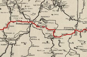
WisDOT built a bypass around the city of Rhinelander in the 1990s and created a business loop along the old highway through the town.
US 8 merges with Minnesota State Highway 95 (MN 95) at a roundabout about two miles (3.2 km) southwest of Taylors Falls.
The two highways run concurrently for four miles (6.4 km) before WIS 35 turns off to the north at a location in the Town of St. Croix Falls west of Deer Lake.
US 8 continues eastward through forest lands, and WIS 46 joins from the north for a four-mile (6.4 km) concurrency before splitting off to the south.
East of town, the highway continues through rural Rusk County, and US 8 meets WIS 27 in downtown Ladysmith.
[10][11] Upon leaving Ladysmith, US 8 passes through the communities of Tony, Glen Flora, Ingram (where it meets the northern terminus of WIS 73) and Hawkins on its way out of Rusk County.
Further east, US 8 crosses Tripoli and McCord and runs north of Tomahawk as it passes through the Lake Nokomis area.
US 8 turns east again at Cavour and passes through the community of Armstrong Creek one mile (1.6 km) from the Marinette County line.
The highway takes a northward turn and heads across the Menominee River into Michigan near Pier's Gorge Park.
US 8 in Michigan is 2.322 miles (3.737 km) long; in this segment, the road passes by the Dickinson County fairgrounds and Norway Speedway.
The remainder of what is now US 8 was unnumbered secondary highways, and WIS 14 continued north of Armstrong Creek to Florence.
[22] The highway was originally shown on maps running between Forest Lake, Minnesota and Powers, Michigan.
[23] At the time, its planned routing was not previously designated as part of the State Trunkline Highway System in Michigan.
The trunkline connection from Quinnesec south into Wisconsin was part of M-57, which met WIS 57 at the state line.
[24] A map by the American Automobile Association does show the highway continuing east through Faithorn and Hermansville in Michigan to end at US 2.
[26][27] By the next year, the highway was shifted to end in Norway, utilizing a separate crossing of the Menominee River to enter Michigan.
[33][34] A jog in the routing near Almena was removed in 1937 when Wisconsin rerouted the highway to a more direct alignment in the area.
[42][43] As late as 1959, the Michigan State Highway Department still had plans to build the section of US 8 west of Hermansville to the Menominee River.
[45] WisDOT still shows the section of highway needed in their state to extend US 8 to the original eastern terminus in Michigan on internal maps.
[46] In the late 1970s, with ongoing construction and completion of the I-35W freeway in Minnesota, US 8 was routed along I-35W;[47] US 8 was truncated again by 1981 to its current terminus in Forest Lake.
At the time, officials with WisDOT had plans to extend the four-lane divided highway as far west as US 51 near Tomahawk.
[54] Problems related to wetlands in the construction area and bad weather pushed completion of the project back almost a year.
[57] Bill and Jerri Osberg sued the state and seven other parties in April 2003 over runoff from the construction, claiming that it killed hundreds of trees and polluted ponds on their property.
[59] Included in the original lawsuit were six individual WisDOT employees, the primary contractor and a local pet supply company.
[60] The couple settled their claims, and the state pursued the matter against Pagel Construction in a related lawsuit.
[62] The entire length of US 8 in the state has been classified as a North Country Corridor in the Connections 2030 Plan by the department.
The local authorities erected signs along this route to designate it as a business loop of the main highway south of town.