U.S. Route 98 in Florida
They intersect US 29 (N. Palafox Street), a half diamond interchange with Interstate 110 (I-10), and the SR 291 one-way couplet of Dr. Martin Luther King Jr. Drive (southbound) and Davis Highway (northbound).
After a short jaunt on the Bayfront Parkway, US 98 turns south to cross the 3-mile-long (4.8 km) Pensacola Bay Bridge over the eponymous body of water.
Within the city limits of Perry, US 98 and SR 30 makes a sharp turn to the south along US 19 which is also the northern terminus of Alternate US 27 and is named Byron Butler Parkway.
South of Lebanon Junction, US 19-98 runs along sparse residences, trailer parks, a Florida Sheriff's Youth Facility, the Gulf Hammock Wildlife Management Area.
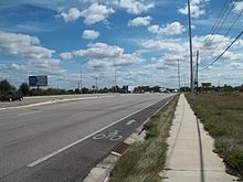
A new four-lane divided bridge was completed by FDOT in the early-2010s,[4] which was originally planned in conjunction with the proposed Suncoast Parkway extension to Red Level.
Before reaching the potential site of this interchange, it runs by a field where American Civil War re-enactments are staged lies just north of the back entrance to a local quarry, which is across from the western terminus of County Road 488.
It then curves east as it passes by some more motels and restaurants on the water across from City Hall then approaches County Road 495 (North Citrus Avenue).
The road leaves the city limits south of the Crystal River Airport, and from there US 19-98 passes the intersection of Ozello Trail (CR 494), then serves as the location of a series of car dealerships, local garages, a Moose Lodge, and other businesses.
South of there, the road passes over a small creek and approaches the Homosassa Springs Wildlife State Park on the west side.
After moving over some steep hills and passing a branch of the Pasco-Hernando Community College as well as a Florida State Trooper police station, US 98 briefly becomes a four-lane divided highway again at Yontz Boulevard, only to resume its status as a two-lane road as it enters the City of Brooksville.
There, the road passes by some local industry, including the garage for Hernando ParaTransit and the county bus system, and then faces an un-gated at-grade crossing with the CSX Brooksville Subdivision.
While both segments go up and down steep hills in the heart of the city, the Broad Street (eastbound) section runs over an old railroad bridge over the CSX Brooksville Subdivision, built in 1936.
Entering the unincorporated community of Ridge Manor West, commercial development designed primarily for travelers begins to dot the landscape as it approaches the interchange with Interstate 75 at exit 301.
The shorter Paul N. Steckle Lane exists on the north side and contains a Hernando County Firehouse, local residences, and one entrance to the Cypress Lake Preserve.
The road officially enters Dade City in the vicinity of the aforementioned drive-in theater, and passes by the Pioneer Florida Museum right next to a former citrus plant.
Across from the south end of that plant is the intersection with eastern County Road 578, and shortly afterwards veers to the left at an at-grade interchange onto the former US 98-301 Truck Bypass, which was converted into mainline US 98-301 in 2007.
US 98-301 moves closer to the CSX Wildwood Subdivision (part of the S-Line), where it encounters the eastern terminus of CR 52 and the Dade City Atlantic Coast Line Railroad Depot.
At County Road 35 Alternate, US 98-301 turns from southeast to southwest as it moves back towards another at-grade interchange with the former "Business" US 98-301, and runs straight south again onto a four-lane divided highway.
Shortly after this intersection, the road prepares to leave the Lakeland city limits beneath the partial cloverleaf interchange with Polk Parkway at Exit 10, which contains loop ramps only from US 98.
The rest of the way through southern Bartow, US 17/98 remains mostly a commercial strip, but this status begins to diminish around the intersection of South Clear Springs Road.
US 98 and hidden SR 700 leaves US 27 at the eastern terminus of State Road 66, thus joining the Florida Cracker Trail in the process, while US 27/SR 25 continue southbound towards Miami.
Running east, this segment of US 98 is two lanes wide, and shortly after leaving a concurrency with US 27 encounters another with another CR 17, this time a county spur of SR 17 that spans from north of Lake Henry to Sebring.
Momentarily running northeast, the first moderate intersection that US 98 encounters is a segment of County Road 68 in Basinger, where it curves southeast and shares yet another concurrency.
The next major site is yet again a grade crossing with the CSX railroad line that carries the Amtrak Silver Star through Okeechobee station.
After crossing a railroad spur leading to the vicinity of the Amtrak station, US 98 leaves SR 70 at the intersection of U.S. Route 441, where it turns south.
There, US 98/441 makes a sharp left turn to the northeast and then the southeast as it runs along the east side of the lake as well as the levee system protecting the coast.
Routes, as well as not-so-hidden SR 15, make a right onto East Main Street and resumes it southwest run along the coast of Lake Okeechobee, or at least within close range of the levees.
The final sections from Canal Point to Palm Beach were designated Temporary US 98 until the early 1960s,[citation needed] because a relocation was planned via SR 710 through Indiantown.
[citation needed] Around 1990, US 441 was realigned onto new road from north of Belle Glade to Twenty Mile Bend and, by the late 2000s, US 98 was transferred to this route as well, the most significant rerouting of US 98 in Florida in nearly half a century.
The Okeechobee-West Palm Beach leg of the route will also be designated as temporary on the 1952 maps because the relocation of the road there, via Indiantown in Martin county, is projected.