Upper Hungary
The word felvidék is also used as a component of the toponym Balaton-felvidék, describing the hilly area north of Lake Balaton, with no connection to the historical Upper Hungary.
[16] The term Upper Hungary often occurs in publications on history as a somewhat-anachronistic translation of other, earlier (then Latin) designations denoting approximately the same territory.
In the 15th century, the "Somorja (Šamorín), Nagyszombat (Trnava), Galgóc (Hlohovec), Nyitra (Nitra), Léva (Levice), Losonc (Lučenec), Rimaszombat (Rimavská Sobota), Rozsnyó (Rožňava), Jászó (Jasov), Kassa (Košice), Gálszécs (Sečovce), Nagymihály (Michalovce)" line was the northern "boundary" of the Hungarian ethnic area.
The Slovaks themselves called the territories of the Kingdom of Hungary to the south of Slovakia Dolná zem ("Lower Land").
The claim for its acquisition, however, was not based on the whole area having a single common name, "Upper Hungary", but on the presence of a Slovak minority in the region.
According to this survey the total population of the counties in Upper Hungary exceeded 2.4 million, with the following ethnic distribution: 59.5% Slovaks, 22% Magyars, 8.3% Ruthenians, 6.7% Germans and 3.6% Jews.
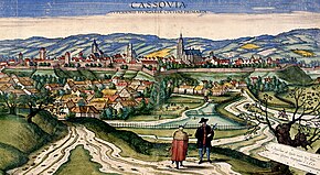
[22] Upper Hungary included the counties of Pozsony, Nyitra, Bars, Hont, Trencsén, Turóc, Árva, Liptó, Zólyom, Gömör és Kis-Hont, Szespes, Abaúj-Torna, Sáros and Zemplén.