Val d'Anniviers
[1] The name of the valley has changed little during its history: "vallis Annivesii" before 1052, then "de Anivesio" in 1193, "Annivies" in 1215, "Anives" in 1243 and "Annevié" in 1253.
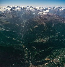
[11] The Val d'Anniviers is located in seismic risk zone 3b, the category of the most exposed regions in Switzerland.
The oldest known dates back to the 6th century when, after heavy snowfalls during the winter followed by long storms and torrential rains in the spring, a section of the Tsirouc mountain collapsed on the village of Morasses.
In 1817, the village of Mayoux was also destroyed, this time by an avalanche: three consecutive very cold winters created a basin of snow at 2,500 meters (8,200 ft), under the Roc d'Orzival.
By freeing itself due to spring warming and thunderstorms, the basin gave way to a second avalanche, two days later, coming from the face of the Roc d'Orzival and ending in the village.