WF postcode area
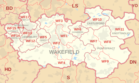
The WF postcode area, also known as the Wakefield postcode area,[2] is a group of 17 postcode districts in north-east England, which are subdivisions of eleven post towns.
These cover much of southern and eastern West Yorkshire (including Wakefield, Pontefract, Dewsbury, Batley, Castleford, Heckmondwike, Knottingley, Liversedge, Mirfield, Normanton and Ossett), plus small parts of South and North Yorkshire.
The approximate coverage of the postcode districts: