Wadi Halfa Salient
The Wadi Halfa Salient, named after Wadi Halfa, a nearby Sudanese city 22 kilometers south of the border, is a salient of the international border between Egypt and the Sudan along the Nile River to the north.
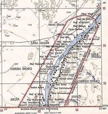
[1] In 1899, the border between the Anglo-Egyptian Sudan and Egypt was defined by the condominium treaty to run along the 22nd degree north of latitude.
Besides the Wadi Halfa Salient, there are two more areas where the administrative border deviated from the 22nd degree north of latitude, both to the east of Wadi Halfa: the Halaib Triangle on the Red Sea coast, north of the original 1899 border, and the much smaller area around Bir Tawil, south of the original border.
The largest town and only one with a population exceeding 2000 was Dubayrah (Arabic: دبيرة).
A superimposition of the map with current NASA WorldWind satellite images shows the extent of flooding in the area of the salient.