Wangunk
The people formed new communities of Christian Indians, relocating to central New York, and then to the Great Lakes area, settling in Wisconsin.
[15] Like other Algonquian groups, the Wangunk political leadership rested with an individual leader called a sachem, based on English settler documentation.
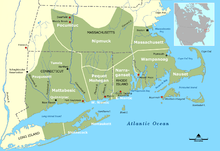
The Wangunk's proximity to the Connecticut River made their homeland desirable for European fur traders, leading to conflicts with the Pequot tribe over the area.
Colonial accounts suggest that Wangunk sachem Sequassen' assisted the Pequot in their attack on Wethersfield, where he resided at the time.
[13] During this period, Natives and settlers living at Middletown are documented as engaging in a series of land transactions, culminating in a written reservation deed in 1673.
The establishment of the reservation was economically harmful to the Wangunk, who needed a larger area of land to carry on their traditional agricultural and hunting practices.
This neutrality may have been coerced, as English people passed a series of laws during this period limiting Indian economic opportunities and access to weapons, and demanding hostages from tribes.
The English population of Middletown grew, and in the late 17th century colonists began building homes on Wangunk Meadows on the east bank of the river next to the reservation.
The meeting house served to justify increased settler claims to reservation land, which they said the Wangunk were not putting to proper use.
[5] In 1757, after two petitions from settlers to the Connecticut General Assembly, Wangunk Richard Ranney, who lived away from the reservation, made a land claim and was granted 10 acres.
[26] Connecticut historian John William De Forest (1826–1906), wrote that after the sale of the last Wangunk lands: "Mary Cushory was living on the town of Chatham as late as 1771.
In 1785, a committee was appointed by the Legislature to collect all of the money due on the Indian lands at Wangunk, and pay it over to the proprieters, who seem, at that time, to have entirely left the place.
"[27] Other Wangunk joined the Farmington Indians in Connecticut, a group that formed when the Tunxi invited other Native Americans to move to their reservation and become a new tribe.
[32] On this high place, that swells so fair, O'er town and river, grove and lea, We stand, O God, with song and prayer.
Richard Treat established a school for Wangunk children in 1734, which aimed to teach Christian scripture and morality, in addition to the English language.
[63] In 2003, Van Thomas Green, who claimed to be a Wangunk descendant (through Betty Cuschoy, his great-great-aunt), filed suit against the town of Portland, Wesleyan University, and other parties.
[64] He sought $10 million in damages or compensation, the return of 300 acres to tribal descendants, and federal recognition for his family as a tribe.
[65] In his complaint Green alleged that Indian burial grounds in Glastonbury and Portland, Connecticut, have been desecrated; that from 1799 to 2003 tribal lands were unlawfully transferred in violation of 25 U.S.C.
The court ruled that he was unable to establish any causal connection between the injury and/or conduct complained of and some challenged action of defendants Wesleyan University and others.
[66] The video also includes interviews with Gary O'Neil and genealogist Vicki Welch, Director at Seven Generations Research, both of whom challenge Green's claims to being a Wangunk descendant.
Gary "Red Oak" O'Neil stated that "hundreds of Wangunks" are living today in Connecticut, Massachusetts, and Rhode Island.
[9][10] In October 2023, City of Middletown Mayor Benjamin Florsheim presented a proclamation in recognition of Indigenous Peoples' Day to Gary "Red Oak" O'Neil, a Wangunk descendant.
[11] A press release from the Mayor's office read, "The Wangunk people are the native inhabitants and caretakers of the land in and around Middletown, and have lived in this area for thousands of years.