Washington County, Tennessee
At the outbreak of the Revolutionary War in 1776, the Wataugans organized the "Washington District", which was governed by a committee of safety.
North Carolina initially refused to recognize the settlements as legal, but finally agreed to annex the district after the settlers thwarted an invasion by hostile Cherokees.
Franklin was an early attempt to create a fourteenth state prior to Kentucky and Vermont's admissions into the union.
Washington County was divided between pro-Union and pro-secession sentiments at the outset of the Civil War.
In Tennessee's Ordinance of Secession referendum on June 8, 1861, Washington Countians voted 1,445 to 1,022 in favor of remaining in the Union.
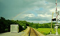
[6] One of the bridges targeted by the East Tennessee bridge-burners in November 1861 was located in what is now Watauga near the Washington-Carter county line.
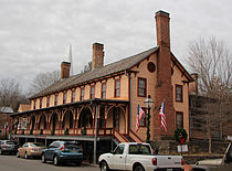
Significant restoration is underway, as well as publicizing the railroad heritage of the Johnson's Depot Historic District.
Other historic properties are being restored as representative of Johnson City's late nineteenth and early twentieth-century era as a railway center.
[8] The western portion of the county is situated in the Ridge-and-Valley Appalachians, which are characterized by long, narrow ridges roughly oriented northeast-to-southwest.
[9] Buffalo Mountain, a long ridge that straddles much of Washington's eastern boundary, contains the county's highest point, 3,520-foot (1,070 m) Pinnacle Knob.
Sampson Mountain, which rises in the southeastern part of the county, is home to a designated national wilderness area.