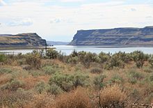
Water gap
A water gap is usually an indication of a river that is older than the current topography.
The likely occurrence is that a river established its course when the landform was at a low elevation, or by a rift in a portion of the crust of the earth having a very low stream gradient and a thick layer of unconsolidated sediment.
In a hypothetical example, a river would have established its channel without regard for the deeper layers of rock.
A later period of uplift would cause increased erosion along the riverbed, exposing the underlying rock layers.
Water gaps are common in the Ridge-and-Valley Appalachians of eastern North America.