Water resources management in the Dominican Republic
Rapid economic growth and increased urbanization have also affected environmental quality and placed strains on the Dominican Republic's water resources base.
In addition, the Dominican Republic is exposed to a number of natural hazards, such as hurricanes, storms, floods, Drought, earthquakes, and fires.
Global climate change is expected to induce permanent climate shocks to the Caribbean region, which will likely affect the Dominican Republic in the form of sea level rise, higher surface air and sea temperatures, extreme weather events (such as tropical storms and hurricanes), increased rainfall intensity (leading to both more frequent and severe flooding) and more frequent and more severe "El Niño-like" conditions.
However, the tourism industry is threatened by the deficiency of the water and sewerage services and the environmental pollution caused by inadequate management and disposal of sewage and solid waste.
The Dominican Republic's internal water resources per capita is 2,430 cubic meters, which is below the average for Central American and the Caribbean region, 6,645.
According to the World Bank only Barbados, the DR, Mexico, and Peru exceed 10 percent demand in the Latin America and Caribbean region.
Many coastal aquifers are at risk of contamination from agrochemicals and poorly located solid waste disposal, contributing to water scarcity by making resources unavailable.
In some cases, high salinity, pesticides and other pollutants are present in water close to agricultural, urban, and industrial areas.
Downstream of metal mining, flows of effluents also show high levels of cadmium, chrome and other heavy metals – high levels of mercury have been found in the waters of Samana Bay and the presence of pesticides and persistent organic pollutants (such as DDT and PCBs) in estuary mollusks has also been reported.
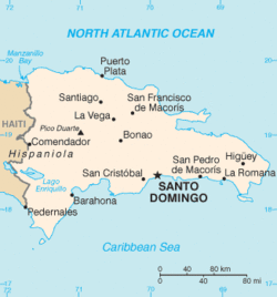
For example, in nine provinces located in the Central, Northeastern and Eastern part of the country less than 70% of the population had access to an improved source of water supply according to the 2002 census.
According to the Food and Agriculture Organization, solutions should be sought in the use of better technology, efficient operation of irrigation systems and adequate means of financial support.
The basin is managed by the ‘Service des Ressources en Eau’ (SNRE) in Haiti and by the ‘Instituto Nacional de Recursos Hídricos’ (INDRHI) in the Dominican Republic.
Basin disputes have mostly taken root because of complex economic, social and political reasons, rather than because of a lack of support or coordination by both technical areas.
[10] According to the Food and Agriculture Organization, water fees are too low to meet maintenance and operation requirements for hydraulic infrastructure.
[6] According to the Food and Agriculture Organization, annual government investment in water resources and irrigation infrastructure is in the order of US$100 million.
[1] The Dominican Republic is exposed to a number of natural hazards, such as hurricanes, storms, floods, drought, earthquakes, and fires.
The destructive force of these phenomena can be enormous - in 1998 Hurricane Georges caused economic losses estimated at US$2,193 (14 percent of gross national income), and 235 deaths.
[1] Global climate change is expected to induce permanent climate shocks to the Caribbean region, which will include sea level rise, higher surface air and sea temperatures, extreme weather events (such as tropical storms and hurricanes), and more frequent and more severe "El Niño-like" conditions.
Demographic growth accelerated environmental degradation, deforestation, and lack of mitigation measures will intensify the effect of disasters in the future.
[1] In terms of climate change effects on water resources, and according to the Dominican Republic's first communication, it is expected a great decrease in spatial distribution of rainfall, and total runoff for the year 2100, demonstrating a structural change that intensifies the transition from the most humid zones to the driest and an expansion of the areas of the country that are historically the driest.
[14] In May 2008 the World Bank has approved a US$80 million loan to restore and strengthen irrigation, electricity, water, and sanitation infrastructure damaged by Tropical Storms Olga and Noel, enhance critical infrastructure to reduce future storm-related effects, and strengthen basic capacity for future risk management in INDRHI and CDEEE.