Weald
[4] The rocks of the central part of the anticline include hard sandstones, and these form hills now called the High Weald.
The first Iguanodon was identified after the fossil collector and illustrator Mary Ann Mantell supposedly unearthed some fossilised teeth by a road in Sussex in 1822.
[6] Prehistoric evidence suggests that, following the Mesolithic hunter-gatherers, the Neolithic inhabitants had turned to farming, with the resultant clearance of the forest.
[9] The area was sparsely inhabited and inhospitable, being used mainly as a resource by people living on its fringes, much as in other places in Britain such as Dartmoor, the Fens and the Forest of Arden.
[9] Over the centuries, deforestation for the shipbuilding, charcoal, forest glass, and brickmaking industries has left the Low Weald with only remnants of that woodland cover.
This year came Ælle to Britain, with his three sons, Cymen, and Wlenking, and Cissa, in three ships; landing at a place that is called Cymenshore.
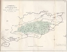
Many places within the Weald have retained names from this time, linking them to the original communities by the addition of the suffix "-den": for example, Tenterden was the area used by the people of Thanet.
Permanent settlements in much of the Weald developed much later than in other parts of lowland Britain, although there were as many as one hundred furnaces and forges operating by the later 16th century, employing large numbers of people.
[12] In 1264 during the Second Barons' War, the royalist army of King Henry III of England marched through the Weald in order to force the submission of the Cinque Ports.
In retribution, King Henry ordered the execution of any Weald archers who were captured alive, for instance beheading 300 after a local shot his cook.
[13] In the first edition of On The Origin of Species, Charles Darwin used an estimate for the erosion of the chalk, sandstone and clay strata of the Weald in his theory of natural selection.
[14] Modern chronostratigraphy shows that the Weald Clays were laid down around 130 million years ago in the Early Cretaceous.
Its landscape is described as one of rolling hills, studded with sandstone outcrops and cut by streams to form steep-sided ravines (called gills); small irregular-shaped fields and patches of heathland, abundant woodlands; scattered farmsteads and sunken lanes and paths.
[17] There are centres of settlement, the largest of which are Horsham, Burgess Hill, East Grinstead, Haywards Heath, Tonbridge, Tunbridge Wells, Crowborough; and the area along the coast from Hastings and Bexhill-on-Sea to Rye and Hythe.
It is in effect the eroded outer edges of the High Weald, revealing a mixture of sandstone outcrops within the underlying clay.
Some areas, such as the flat plain around Crawley, have been utilised for urban use: here are Gatwick Airport and its related developments and the Horley-Crawley commuter settlements.
Otherwise the Low Weald retains its historic settlement pattern, where the villages and small towns occupy harder outcrops of rocks.
The Brighton Main Line followed the same route as its road predecessors: although it necessitated the long tunnel near Balcombe and the Ouse Valley Viaduct.
The principal main-line railway to Hastings had to negotiate difficult terrain when it was first built, necessitating many sharp curves and tunnels; and similar problems had to be faced with the Ashford-Hastings line.
In his novel Memoirs of a Fox-hunting Man, the poet and novelist Siegfried Sassoon refers to "the agricultural serenity of the Weald widespread in the delicate hazy sunshine".
[26] John Evelyn (1620–1706), whose family estate was Wotton House on the River Tillingbourne near Dorking, Surrey, was an essayist, diarist, and early author of botany, gardening and geography.
The second half of E. M. Forster's A Room with a View takes place at the protagonist's family home, "Windy Corner", in the Weald.
Sir Winston Churchill, British statesman and a prolific writer himself, did much of his writing at his country house, Chartwell, near Westerham, which has extensive views over the Weald.