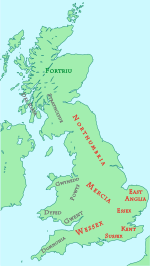
History of Sussex
[2] Near Pulborough, tools have been found that date from around 35,000 years ago and that are thought to be from either the last Neanderthals in northern Europe or pioneer populations of modern humans.
[7] The archaeology at the Beedings spans a crucial cultural transition in the European Palaeolithic and therefore provides an important new dataset for the analysis of late Neanderthal groups in northern Europe and their replacement by modern human populations.
[18] Towards the end of the Iron Age in 75BC, people from the Atrebates, one of the tribes of the Belgae, a mix of Celtic and German stock, started invading and occupying southern Britain.
[24][25] The foundation of the Kingdom of Sussex is recorded by the Anglo-Saxon Chronicle for the year AD 477, saying that Ælle arrived at a place called Cymenshore in three ships with his three sons and killed or put to flight the local inhabitants.
[63] Evidence of this is seen in the Domesday Book by the survey of Worth and Lodsworth under Surrey, and also by the fact that as late as 1834 the present parishes of North and South Ambersham in Sussex were part of Hampshire.
[54][64] During the Hundred Years' War, Sussex found itself on the frontline, convenient both for intended invasions and retaliatory expeditions by licensed French pirates.
[65] Hastings, Rye and Winchelsea were all burnt during this period[65] and all three towns became part of the Cinque Ports, a loose federation for supplying ships for the country's security.
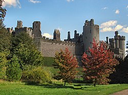
[65] Sussex escaped the worst ravages of the English Civil War, although in 1642 there were sieges at Arundel and Chichester, and a skirmish at Haywards Heath when Royalists marching towards Lewes were intercepted by local Parliamentarians.
[68] Despite Sussex being under Parliamentarian control, a heavily disguised Charles II was able to evade capture on his journey through the county after the Battle of Worcester in 1651 and make his escape to France from the port of Shoreham.
[73] With the outbreak of World War II, Sussex found itself part of the country's frontline with its airfields playing a key role in the Battle of Britain and with its towns being some of the most frequently bombed.
In 2013, Secretary of State for Communities and Local Government Eric Pickles formally recognised and acknowledged the continued existence of England's 39 historic counties, including Sussex.
[124] Cade's rebellion was not just supported by the peasant class, but many gentlemen, craftspeople and artisans, as well as the Abbot of Battle and Prior of Lewes, flocked to his standard in revolt against the corrupt government of Henry VI.
[124] At the time of the English Civil War the county's sympathies were divided: Arundel supported the King, while Chichester, Lewes and the Cinque Ports were for Parliament.
[128] At the beginning of the 19th century, agricultural labourers' conditions took a turn for the worse with an increasing amount of them becoming unemployed, while those remaining employed faced their wages being forced down.
Typically, a threatening letter would be sent to a local farmer or leader demanding that automated equipment such as threshing machines should be withdrawn from service, wages should be increased and there would be a threat of consequences if this did not happen.
[71][72] Eventually the army was mobilised to contain the situation in the eastern part of the county, whereas in the west the Duke of Richmond took action against the protesters by the use of the yeomanry and special constables.
[129] One of the main grievances of the Swing protesters had been what they saw as inadequate Poor Law benefits, Sussex had the highest poor-relief costs during the agricultural depression of 1815 to the 1830s and its workhouses were full.
[132] The Sussex Yeomanry was founded in 1794, and numbers of gentlemen and yeomen volunteered to join the part-time cavalry regiment to serve in case of invasion by Bonaparte.
[136] With the declaration of the Second World War on 3 September 1939, Sussex found itself part of the country's frontline with its airfields playing a key role in the Battle of Britain and with its towns being some of the most frequently bombed.
[74] As the Sussex regiments were serving overseas for large parts of the war, the defence of the county was undertaken by units of the Home Guard with help between 1941 and early 1944 from the First Canadian Army.
[75] A legacy of the D-Day landings are the sections of Mulberry harbour that lay broken and abandoned on the sea floor 2 miles (3.2 km) off the coast, of Selsey Bill, having missed the invasion.
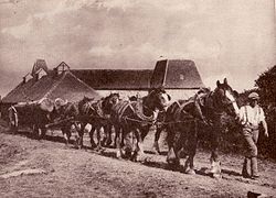
The Wealden parts are mostly wet sticky clays or drought-prone acid sands and often broken up into small irregular fields and woods by the topography, making it unsuitable for intensive arable farming.
The chalk downlands were traditionally grazed by large numbers of small Southdown sheep, suited to the low fertility of the pasture, until the coming of artificial fertiliser made cereal growing worthwhile.
Historically, the fisheries were of great importance, including cod, herring, mackerel, sprats, plaice, sole, turbot, shrimps, crabs, lobsters, oysters, mussels, cockles, whelks and periwinkles.
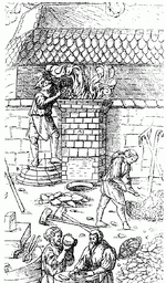
[148] Little evidence has been found of iron production after the Romans left until the ninth century, when a primitive bloomery, of a continental style, was built at Millbrook on Ashdown Forest, with a small hearth for reheating the blooms nearby.
This allowed a continuous process that usually ran during the winter and spring seasons, ceasing when water supplies to drive the bellows dwindled in the summer.
[149] "Full of iron mines it is in sundry places, where for the making and fining whereof there bee furnaces on every side, and a huge deale of wood is yearely spent..." From William Camden's description of 17th century Sussex.
[159] The poet Michael Drayton in his poem Poly-Olbion, published in the early 17th century, made the trees denounce the iron trade: Jove's oak, the war-like ash, veined elm, the softer beech Short hazel, maple plain, light asp and bending wych Tough holly and smooth birch, must altogether burn.
In the first quarter of the 20th century, Burgess Hill and the Hassocks and Hurstpierpoint areas had many kilns, clay pits and similar infrastructure to support the clay industry; nowadays the majority of this form of industry has left the area, although it still can be seen in place names such as "Potters Lane", "Meeds Road", "The Kiln"; Meeds Pottery was once a significant pottery in the centre of Burgess Hill.
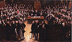
[186] There followed years of discussion and argument with various groups proposing different routes; then finally in 1837 the London and Brighton Railway Bill with branches to Shoreham and Newhaven received Royal assent.