Weber County, Utah
Its county seat and largest city is Ogden,[2] the home of Weber State University.
The Weber Valley was visited by many trappers seeking beavers and muskrats along its streams.
Peter Skene Ogden passed through in 1826, representing the Hudson's Bay Company.
John C. Frémont explored the Weber Valley in 1843 and made maps of the area.
The Fremont reports encouraged readers to seek their fortunes in the western frontier.
Miles Goodyear was a fur trapper who constructed a way station on the Weber River in 1845.
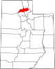
A final adjustment in 1880 concerning the various lands in the Great Salt Lake area brought the county's borders to their present configuration.
[6] As Nevada and the State of Utah evolved, Weber County was trimmed so that it now occupies a stretch of the Wasatch Front, part of the eastern shores of Great Salt Lake, and much of the rugged Wasatch Mountains.
The county's highest elevation is Willard Peak in the Wasatch Mountains, at 9,763 ft (2,976 m) ASL.
The east/west demarcator was selected as Wall Avenue which runs parallel to downtown Ogden.
There were 89,595 households in Weber County with an average size of 2.93 of which 64,544 (72.0%) were families and 25,051 (28.0%) were non-families.
As of the 2010 United States Census, there were 231,236 people in the county, organized into 78,784 households and 57,867 families.
In no national election since 1964 has the county selected the Democratic Party candidate.