West Green, West Sussex
[1] Northgate and the town centre lie to the east, Southgate is to the south, Ifield is to the west and Langley Green shares a border to the north.
[2] A small settlement developed in the Anglo-Saxon era around a crossroads where a northeast–southwest trackway connecting the main Saxon-era estates and farms of the Weald crossed an east–west route between Worth and Ifield.
After the Norman Conquest, the pattern of land use and travel changed, and a new north–south route between London and the south coast developed slightly to the east.
[6] In the 19th century, the increasing prosperity of Crawley—by now, a thriving market town—stimulated residential growth in West Green.
This took place haphazardly and without any planning: local builders erected individual houses or streets speculatively and in a mixture of styles.
[9] The variety of villas, semi-detached houses and terraces in Leopold, Spencers, Victoria, Albany and Princess Roads—built in the 1880s just north of the railway line—[10] typify this.
[13] John George Haigh, who moved to Crawley from London in 1943, carried out six murders—known as the "Acid Bath Murders"—at a workshop in Leopold Road between 1944 and 1949.
The case brought notoriety to the town and aroused considerable interest among local people.
In 1947, the Development Corporation granted the design contract for 34 houses to architectural practice Godman & Kay.
The Horsham-based building firm Hoad & Taylor built the houses at a cost of £45,220 (£2,077,000 today)[22], and residents moved in during the summer of 1949.
[23] By that time, the neighbourhood centre—with shops, post office, community centre and public house—had been established at the junction of Ewhurst Road and West Green Drive.
The southeastern corner of the neighbourhood was redeveloped early in the 21st century as part of the Borough Council's efforts to improve the town centre.
[25] Around the same time at the other end of the High Street, and again just within the boundary of West Green, the Crawley Leisure Park was built on the site of the Sun Inn.
[28] According to the census, 91.2% of residents are White, 6.2% are Asian or Asian-British, 1% are Black or Black-British, 0.9% are mixed-race and 0.7% are from another ethnic background.
[31] It replaced a 1930s building which had in turn succeeded a small cottage hospital at the south end of Crawley High Street.
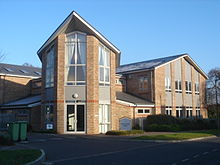
[33] Crawley's ambulance station was moved to playing fields off Ifield Avenue by the early 1980s from its former town-centre location.
[12][36] St Peter's Church was designed by W. Hilton Nash[37] and built by local construction firm owner Richard Cook.
Crawley Baptist Church, established in 1883, moved to Crabtree Road in West Green in 1954.
[49] The George Hotel, listed at Grade II*, is an early 16th-century coaching inn which expanded over the next two centuries to take over surrounding buildings.
Crawley's location midway between London and Brighton on the direct route between them, which was turnpiked in 1770, contributed to its growth, as it became the natural stopping place for traffic of all types.
The oldest visible parts of the building are the southernmost bay, where there is 17th-century brickwork and timber, and the chimney from the same period.