West Kameng district
Tibetan Buddhism got a strong foothold among the tribal groups as early as in the 7th century, where the Kachen Lama constructed the Lhagyala Gompa in Morshing.
Upon the arrival of the British, the present-day West Kameng was placed under what was known as the North-East Frontier Agency (later, Arunachal Pradesh).
In 1946, the district area was carved out of the Balipara, with the name Sela Sub-Agency and its headquarters continued to be Charduar of Assam.
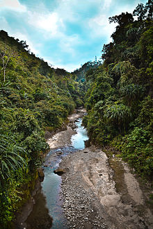
It comprises all the regions inhabited by the Miji community[2] West Kameng district occupies an area of 7,442 square kilometres (2,873 sq mi),[3] comparatively equivalent to Papua New Guinea's New Ireland.
[9] Like most of Arunachal Pradesh, Jhum, or shifting cultivation, is practised among the tribes who live in lower elevations where there is a temperate or subtropical climate.
With the improving of roads condition and investment in hospitality sectors the flow of tourists can be seen round the year.
There are 4 Arunachal Pradesh Legislative Assembly constituencies located in this district: Dirang, Kalaktang, Thrizino-Buragaon and Bomdila.
[10] According to the 2011 census West Kameng district has a population of 83,947,[12] roughly equal to the nation of Antigua and Barbuda.
Languages of West Kameng (2011)[14] Most of the inhabitants are Buddhist, though the Aka, Bugun (Khowa), and Miji have indigenous religions and those tribe members follow a mix of Buddhism, Hinduism, and Donyi-Polo (a form of Animism).
In 1989 West Kameng district became home to the Eaglenest Wildlife Sanctuary, which has an area of 217 km2 (83.8 sq mi).