Western Cape
The Western Cape (Xhosa: iNtshona-Koloni; Afrikaans: Wes-Kaap [ˈvɛskɑːp]) is a province of South Africa, situated on the south-western coast of the country.
It is the fourth largest of the nine provinces with an area of 129,449 square kilometres (49,981 sq mi), and the third most populous, with an estimated 7 million inhabitants in 2020.
The only natural harbour is Saldanha Bay on the west coast, about 140 kilometres (90 mi) north of Cape Town.
But fresh water coming off Table Mountain and Devil's Peak allowed the early European settlers to build Cape Town on the shores of this less than satisfactory anchorage.
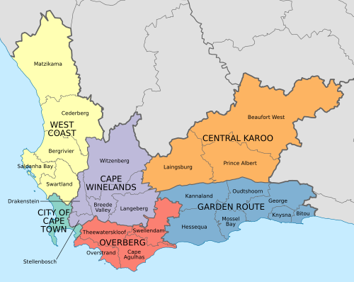
The escarpment marks the southwestern edge of South Africa's central plateau (see the middle and bottom diagrams on the left).
[citation needed] The West Coast and Little Karoo are semi-arid regions and are typified by many species of succulents and drought-resistant shrubs and acacia trees.
The Garden Route on the south coast (between the Outeniqua Mountains and the Southern Indian Ocean) is extremely lush, with temperate rainforest (or Afromontane Forest) covering many areas adjacent to the coast, in the deep river valleys and along the southern slopes of the Outeniqua mountain range.
The Western Cape is climatologically diverse, with many distinct micro- and macroclimates created by the varied topography and the influence of the surrounding ocean currents.
[citation needed] The La Niña phase of the El Niño-Southern Oscillation cycle tends to increase rainfall in this region in the dry season (November to April).
The effect on the summer rainfall areas is stronger and has led to severe drought in strong El Niño events.
Snow is a common winter occurrence on the Western Cape Mountains occasionally reaching down into the more inland valleys.
[28] In December 1968, the South African Student Organization (SASO) was formed at a conference held in Marianhill, Natal.
[29] In 1974, South African Minister of Bantu Education and Development MC Botha, constituted the imposition of using Afrikaans as a medium of instruction in black schools, effective with students in Grade 7 (Standard 5) upwards.
[30] As early as March 1976, students began passive resistance against Afrikaans, fueling the outbreak of the Soweto Uprising on 16 June 1976.
Poster parades by UWC and Black Power Salute marches by UCT was broken by the police, resulting in 73 students getting arrested and detained at Victor Verster Prison, near Paarl.
[citation needed] According to a report by the Truth and Reconciliation Commission (TRC), the Western Cape experienced the second highest number of deaths and casualties associated with the 1976 uprising protests.
The National Party (NP) won 53% of the votes and 23 seats in the 42-seat provincial legislature, and Hernus Kriel, a former Minister of Law and Order, was elected Premier.
The NNP went into coalition with the Democratic Party (DP), which won 5 seats, to form a government, and Morkel remained Premier.
The NNP instead went into coalition with the ANC; Gerald Morkel, who was opposed to the split, resigned as Premier and was replaced by Peter Marais.
In 2002 Marais resigned as Premier due to a sexual harassment scandal, and was replaced by NNP leader Marthinus van Schalkwyk.
During the 2003 floor-crossing period four members of the provincial parliament crossed to the ANC, giving it an absolute majority of 22 seats in the 42-seat house.
The ANC-NNP coalition continued in power, but van Schalkwyk took up a ministerial post in the national cabinet and was replaced as Premier by the ANC's Ebrahim Rasool.
The NNP was finally dissolved after the 2005 floor-crossing period and its members joined the ANC, again giving that party an absolute majority of 24 seats.
The people of the province elect the 42-member Western Cape Provincial Parliament every five years by a system of party-list proportional representation.
The sixth provincial parliament was elected in 2024; 24 seats are held by the Democratic Alliance, 8 by the African National Congress, 3 by the Patriotic Alliance, 2 by the Economic Freedom Fighters, and 1 each by the African Christian Democratic Party, Al Jama-ah, Good, Freedom Front Plus, and National Coloured Congress.
Limited access motorways are limited to the Cape Metropolitan Area, Winelands and Garden Route, however due to the low population density of the remainder of the province, the highways remain efficient and high-speed, except during peak holiday travel seasons, when travel can be slow-going in places due to heavy traffic.
[citation needed] The 2022 South African census recorded the population of the Western Cape as 7,433,020 people living in 2,264,032 households.
[55] The Western Cape province has the most highly educated residents with a very skilled workforce in comparison to any other African region.
[57] Four of the top ten entries in Trip Advisor's Best Fine Dining Restaurants – Africa list for 2021 are in the Western Cape.
Distilled wine or brandy is produced in the Cape Winelands, Overberg, and Garden Route districts of the province.