Whittier, California
In the founding days of Whittier, when it was a small, isolated town, Jonathan Bailey and his wife, Rebecca, were among the first residents.
As the city grew, the citizens named it after John Greenleaf Whittier, a respected Quaker poet, and deeded a lot to him.
[6] The area of Nieto's land grant was reduced in 1790 as the result of a dispute with Mission San Gabriel.
Nieto built a rancho for his family near Whittier, purchased cattle and horses for his ranch, and planted cornfields.
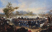
At the time of the 1840s Mexican–American War, much of the land that became Whittier was owned by Pio Pico, a rancher and the last Mexican governor of Alta California.
[6] After the war, German immigrant Jacob F. Gerkens paid the U.S. government $234 to acquire 160 acres (0.6 km2) of land under the Homestead Act and built the cabin known today as the Jonathan Bailey House.
The area soon became known as a thriving citrus ranching region, with "Quaker Brand" fruit shipped all over the United States.
For many years, the sole means of transport from this area to Los Angeles was by foot or horse and wagon over rough dirt roads, impeding settlement, development, and the export of agriculture.
[12] The businessmen covered the $43,000 construction cost for the six-mile spur, which branched off from the Southern Pacific mainline at a junction near what is now Studebaker Road between Firestone Boulevard and Imperial Highway.
In 1904, the Pacific Electric opened the trolley line known as "Big Red Cars" from Los Angeles to Whittier.
In the first two decades, over a million passengers a year rode to and from Los Angeles on the Whittier Line.
In 1955, the Civic Center complex was completed, and the City Council met in new chambers for the first time on March 8, 1955.
With a capacity of 1,700, the 1917 meeting house had a balcony and was constructed of brick with mahogany paneling and pews.
The present meeting house, dedicated in 1975, has many architectural elements and materials from the 1917 building, including the stained glass windows and mahogany interior.
By 1906, Whittier College was an educational institution with laboratories, boarding halls, a large gymnasium, and athletic fields.
Oscar's brother, Samuel Mendenhall, helped bring in the water system and post office.
Whittier was the first home to Azusa Pacific University, established in 1899 by the Quaker community and a Methodist evangelist under the name Training School for Christian Workers.
The seismic event, which registered 5.9 on the moment magnitude scale, killed eight people and damaged many of uptown Whittier's historic buildings.
In the years following the earthquake, the city's deteriorating uptown business district became the focus of renewed development, meeting opposition from many Whittier citizens.
According to the United States Census Bureau, the city has an area of 14.7 square miles (38 km2), virtually all land.
Whittier is bordered by Hacienda Heights to the northeast, City of Industry to the north, and several other unincorporated communities in the San Gabriel Valley mostly along its northern sections.
The area around Philadelphia Street and Greenleaf Avenue is known as Uptown Whittier and contains the traditional central business core.
Whittier is about 15 miles (24 km) inland of the Pacific Ocean, resulting in higher daytime temperatures, and since it lies at a higher elevation than the cities further west, cold air drains into the lower elevation of the Los Angeles Basin, causing warmer nighttime lows, an example of thermal inversion.
With an initial collection of 60 books and 200 magazines, the library facilities began in the Woody Building as a reading room maintained by Hester in exchange for space for his telegraph office.
In 1907, a Carnegie grant funded building construction at Bailey and Greenleaf that many Whittierites fondly remember.
Through their efforts and those of the board members, librarians, and citizen fundraising groups, the new library was completed at the Washington Avenue site in May 1959.
St Gregory The Great School has been Number One in their deanery for the Academic Decathlon two consecutive years.
Foothill Transit line 274 originates at Beverly & Norwalk and proceeds north to Baldwin Park via Workman Mill Road and Puente Avenue.
State Route 72 runs via Whittier Boulevard and forms part of El Camino Real.
Much of Whittier is built out, so the 74-acre (30 ha) site brings a unique chance for growth in the city.