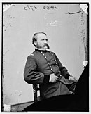
William H. Emory
In 1844, Emory served in an expedition that produced a new map of Texan claims westward to the Rio Grande, which brought him national attention as the war with Mexico seemed imminent.
His mapmaking skills were so superb and detailed with such great accuracy that he often made other maps obsolete, thus making him the authority of the trans-Mississippi west.
At the start of the Mexican–American War, Emory was selected to join General Stephen Watts Kearny and the Army of the West to take New Mexico and California.
Published by the Thirtieth United States Congress in 1848 as Notes of a Military Reconnaissance from Fort Leavenworth to San Diego, it became an important guide book for the road to Southern California.
A dispute arose among the Mexicans and Americans over the location of the starting line near El Paso caused by an error in the original map referred to in the Treaty of Guadalupe Hidalgo (1848).
A compromise by John Bartlett brought an international incident when neither side agreed to the boundary and threatened renewed hostilities in the Mesilla Valley above El Paso.
[3] A compromise was reached with the Gadsden Purchase of 1854, and Emory was selected to lead the American boundary commission to survey, 1855–1856, the new boundary line (earlier he had influenced the debate over approving the treaty by advising Senator Thomas Jefferson Rusk of Texas on the best route for a southern transcontinental railroad, one of the key points of the Gadsden Treaty).
But William H. Emory did more than just map the terrain; he also made notes about the plant life as well as the people who inhabited the sparsely populated Southwest.
"[2] His multi-volume boundary survey published as the Report of the United States and Mexican Boundary Commission, Made Under the Direction of the Secretary of the Interior, 2 vols (Washington, GPO, 1857–1859, reprint Austin:Texas Historical Association, 1987) was not only a contribution to understanding the geography of the region but was a long-standing scientific contribution to the natural history of the region.
At the end of the war, Emory held the rank of colonel in the regular army and a brevet (honorary promotion) as major general.
After the war, Emory held a number of posts, most importantly commander of the Department of the Gulf (which included the Federal troops in Louisiana, Arkansas, and Mississippi)–a demanding and dangerous Reconstruction assignment.
[9] In September 1874, President Ulysses S. Grant ordered Emory to New Orleans, where he successfully negotiated a peace with the conservative White League who had taken over the city by military force.
[13] The first specimens of this snake species were collected by John H. Clark and Arthur Schott at Howard Springs, Texas, under Emory's leadership during the United States and Mexican Boundary Survey.