Winthrop, Massachusetts
It is the southernmost part of the North Shore area, with a 7-mile (11 km) shoreline that provides views of the Atlantic Ocean to the east and of the Boston skyline to the west.
[4][5] The present town is named after John Winthrop (1587–1649), second governor of the Massachusetts Bay Colony and an English Puritan leader.
On April 8, 1630, Winthrop departed from the Isle of Wight, England on the ship Arbella, arriving in Salem in June where he was met by John Endecott, the first governor of the colony.
The town is considered the northern dividing line between Boston Harbor to its west and Massachusetts Bay to its east.
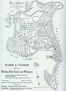
The town is divided into several neighborhoods with a central downtown area, including Court Park and Cottage Park along the Boston Harbor side of town, and Point Shirley, Cottage Hill, Winthrop Beach, Ocean Spray, and Winthrop Highlands on the Massachusetts Bay side.
As a result of the expansion of Logan International Airport, part of four of the runways (4L/22R, 4R/22L, 15R/33L, and most of 15L/33R) lies within what was once the water rights of the town.
By land, Winthrop is 5.5 miles (8.9 km) from Beacon Hill, the measuring point for all road signs in Massachusetts.
The island has a sordid past as an internment camp for Native Americans during King Philip's War, a quarantine station where many immigrants died, and the site of a county jail.
The island is now popular with many Winthrop residents, due to the park landscaping and views of Boston Harbor and the Atlantic Ocean.
It enters from the Orient Heights neighborhood of East Boston then passes in a loop around the main body of the town (bypassing Cottage Hill and Point Shirley) before leaving the town to the north, turning into the Winthrop Parkway in Revere.
Two bus routes are provided by Paul Revere Transportation, which run from Point Shirley through the highlands and center of the town and terminate at Orient Heights.
[14] Prior to this, the service was operated by Rapid Transit, which began bus service in Winthrop on January 28, 1940, the day immediately following the closure of the Boston, Revere Beach and Lynn Railroad (known as the "Narrow Gauge") which had a Winthrop Branch (1877–1940) with nine stations.
A water transportation dock is located at the public landing and provides ferry service across Boston Harbor.
Currently, the town operates the service seasonally (May through October) between Winthrop, Quincy, and Rowes Wharf.
It is a red, white, and blue striped tower capable of holding 1 million US gallons (3,800 m3) of water.
In July 2017, Massachusetts Governor Charlie Baker announced a $2.38 million grant to the town to redevelop its Center Business District.
Fort Banks was a United States Coast Artillery fort, which served to defend Boston Harbor from enemy attack from the sea and was built in the 1890s during what is known as the Endicott period, a time in which the coast defenses of the United States were seriously expanded and upgraded with new technology.
It is now replaced with the Fort Heath Apartment building, Seal Harbor condominia, and a small park on the bluff overlooking the Atlantic Ocean and Revere Beach.