Yarmouth, Maine
Meanwhile, the Royal River's four waterfalls within Yarmouth, whose Main Street sits about 90 feet (27 m) above sea level, resulted in the foundation of almost sixty mills between 1674 and 1931.
The annual Yarmouth Clam Festival attracts around 80,000 people (around ten times the town's population) over the course of the three-day weekend.
The Royal River appealed to settlers because its four waterfalls and 45 feet (14 m) rise, within a mile of navigable water, each provided potential waterpower sites.
[4] (It was abandoned two years later, however, due to conflicts with the Native Americans during the early stages of King Philip's War.)
North Yarmouth, Massachusetts Bay Colony (as it then was), was settled in 1636, although Native Americans had already been living in the area, calling it Westcustogo.
After serving seven years in the Massachusetts Bay Colony Company, he was provided with a land grant in North Yarmouth.
[8] Another Englishman, George Felt, who had emigrated to Charlestown, Massachusetts Bay Colony, eleven years earlier, purchased 300 acres of land at Broad Cove from John Phillips, a Welshman, in 1643.
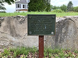
James Lane was the first of their victims, followed the next day by two sons of Mr. Hazelton, who had recently purchased the remaining half of Cousins Island.
[4] The town's Main Street gradually became divided into the Upper Village (also known as the Corner) and Lower Falls, the split roughly located around the present-day U.S. Route 1 overpass (Brickyard Hollow, as it was known).
Yarmouth was home to DeLorme, the large map-making company, with its headquarters, located on Route 1 to the north of the town, housing Eartha, the world's largest revolving and rotating globe.
In 2019, the town approved a final draft of a "streetscape improvement plan" for the Main Street village first discussed in July the previous year.
In 1727, five local men—Samuel Seabury, James Parker, Jacob Mitchell, Gershom Rice and Phineas Jones—were tasked with the management of the new town.
In 1732, "a good road (today's Pleasant Street) was built over the ledge from the meeting-house to the mills at the first falls which, although it was abandoned about 1800 for a less hilly course, may still be easily traced.
In 1756, "to accommodate the teams hauling lumber from the great pine forests inland to the seaboard, a new, more convenient way was laid out by the way of Walnut Hill and the road constructed.
"[8] In 1761, then-Postmaster General Benjamin Franklin ordered milestones placed along the 1673-established route from Boston, Massachusetts, to Machias, Maine, as a northern extension of King's Highway.
[39] Roswell P. Greeley established an express service between Portland and Yarmouth, employing a span of horses and large wagons.
[42] U.S. Route 1 arrived in the late 1940s, at grade and also a bridge over Main Street, shortly after the conclusion of World War II.
[43] A 1944 map shows the Atlantic Highway coming through town, aligning with what became Route 88 up to the point they meet at the end of Spring Street.
The section of Atlantic Highway that runs from Princes Point Road to the northern end of Pleasant Street was laid in the late 1920s.
In 1906, a bridge was built over the Royal River, connecting the Brunswick and Portland trolleys at the Grand Trunk depot in town.
The pedestrian bridge in the Royal River Park is built on old abutments for a trolley line which ran between Yarmouth and Freeport between 1906 and 1933.
There are three bus stop locations: the park and ride lot at the southbound exit 15 ramp of I-295, on Main Street in front of Yarmouth Town Hall, and on either side of Route 1 at Hannaford.
It is named after 15-year-old Yarmouth High School sophomore Elizabeth Ann Condon, who was killed by drunk driver Martha Burke on August 28, 1993, as she walked along Route 1 with her boyfriend.
They are (from east to west): Elsewhere, the North Yarmouth and Freeport Baptist Meeting House (known locally as the Meetinghouse on the Hill) on Hillside Street was built in 1796.
The only graveyard (that is, a burial ground associated with an extant church building) in Yarmouth is located beside the Meeting House on Hillside Street.
[61] Yarmouth news is now reported regularly in a number of different newspapers, including the Portland Press Herald and The Forecaster (Northern Edition).
Established in 1965, the Yarmouth Clam Festival is an annual three-day event which takes place in the town during the third weekend in July, attracting around 120,000 people.
The festival features a parade, food, carnival rides, crafts, a clam-shucking contest, a five-mile run, and a world-class bike race.
"Herbie" was an elm tree that stood by present-day East Main Street (Route 88), at its intersection with Yankee Drive, between 1793 and 2010.
If the subject was born before August 8, 1849, when the town was North Yarmouth (of either Massachusetts or Maine), they are included in the first section below, regardless of when they died.