Zabul Province
Zabul borders Oruzgan in the north, Kandahar in the west and in the south, Ghazni and Paktika in the east.
The primary ecoregion of the province is the central Afghan mountains xeric woodlands.
[5] In 2006, the province's first airstrip was opened near Qalat, to be operated by the Afghan National Army, but also for use by commercial aviation.
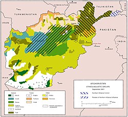
According to the Naval Postgraduate School, the population is primarily Pashtuns, sprinkled throughout around 2,500 remote villages.
Major tribal groups include the Tokhi, Hotak, Nasar, Kharoti, Taraki, Ghilji and the Noorzai and Panjpai Durrani.
[9] 60.8% of the population lived below the national poverty line, one of the highest figures of all of Afghanistan's provinces.