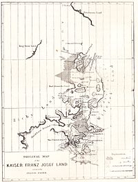
Zichy Land
It is formed by the central cluster of large islands in the midst of the archipelago.
The islands are separated from each other by narrow sounds that are frozen most of the year, forming a compact whole.
[1] This island group was named after Hungarian Count Ödön Zichy (1811-1894) [2] who was, beside Count Johann Nepomuk Wilczek, the second highest sponsor for the Austro-Hungarian North Pole Expedition to Franz Josef Land.
The highest point is 620 metres (2,034 feet) high Peak Parnass located on Wiener Neustadt Island.
The individual islands forming the Zemlya Zichy archipelago are (from North to south):