Zona Austral
It is surrounded by the Zona Sur and the Chacao Channel to the north, the Pacific Ocean and Drake's Passage to the south and west, and the Andean mountains and Argentina to the east.
The deeply indented coastline is filled with islands which preserve the general outline of the continent southward to the Fuegian archipelago, the outside groups forming a continuation of the Chilean Coast Range.
The main chain of the Andes in the west is an enormous rugged mass of ice and snow of an average height of 2,700 m (8,900 ft), sending glaciers to all the western fjords.
The section from 48° to 52° S latitude is a continuous ice-capped mountain range, and some of the glaciers extend from the eastern lakes to the western channels, where they reach the sea-level.
The highest mountain in the section is Lautaro volcano, but the most famous compose the Cordillera del Paine in the south and the Fitz Roy group in the north.
Abrupt walls overlook the Pacific, and great longitudinal and transversal channels and fjords run right through the heart of the range, cutting it generally in a direction more or less oblique to its axis, the result of movements of the Earth's crust.
This region is not fully explored, and all that is known of it is that it is principally composed of the same rocks as the Fuegian Andes, and that the greater part of its upper valleys is occupied by glaciers that reach down to the sea amid dense forest.
The continental coastline features numerous inlets and fjords, from which the mountains seem to rise straight up to great elevations; this is, for example, the case with the Cerro Macá (2,300 m (7,546 ft)) near Puerto Aisén.
The rest of the land consists of literally thousands of islands forming numerous archipelagos interwoven with sometimes-narrow channels, which provide the main routes of navigation.
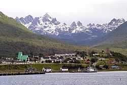
Some of the smaller islands of these groups are also inhabited, though the excessive rainfall of these latitudes and the violent westerly storms render them highly unfavourable for human occupation.
[1] Below the Taitao peninsula is the broad open Gulf of Penas, which carries the coast-line eastward fully 160 km (100 mi) and is noticeably free from islands, with some exceptions.
Messier, Pitt, Sarmiento and Smyth's Channels, which form a comparatively safe and remarkably picturesque inside route for ships, about 540 km (338 mi) in length, separate another series of archipelagoes from the mainland.
[1] The far south contains large expanses of pastures that are best suited for raising sheep, mainly on Isla Grande de Tierra del Fuego.
This strait is one of the world's important sea-lanes because it unites the Atlantic and Pacific oceans through a channel that avoids the rough open waters off Cape Horn.
The Comau Fjord and Vodudahue River traverse the densely wooded country in a north-westerly direction from the Andes to the north-eastern shore of the Gulf of Chacao.
[1] The Cisnes is wholly a Chilean river, draining an extensive Andean region between the 44th and 45th parallels and discharging into the Puyuhuapi Channel, which separates Magdalena Island from the mainland.
The course of the river from lake General Carrera is south and south-west, the short range of mountains in which are found the cerros San Valentín and Arenales forcing it southward for an outlet.
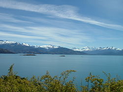
[1] The great Andean lakes of Palena (near the 44th parallel), General Carrera (in lat 46° 30′ S.), Cochrane (47° 15′ S.) and O'Higgins (49° S.), lie partly within Chilean territory.
The area is still heavily forested, although some of the native species of trees that grow in the central and southern parts of the country have given way to others better adapted to a generally colder climate.