1976 Moro Gulf earthquake
The 1976 Moro Gulf earthquake and tsunami occurred on August 17, 1976, at 00:11 local time near the islands of Mindanao and Sulu, in the Philippines.
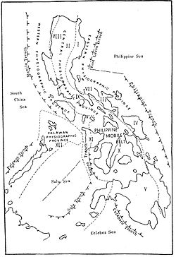
[citation needed] The earthquake occurred in an region where typical seismicity originates at 500 km (310 mi) depth on the Wadati–Benioff zones associated with subduction along the Sangihe and Mindanao islands.
The shock in the North Celebes Sea was associated with the smaller Cotabato Trench; a north–south bathymetric feature along the island's coast where it meets the Moro Gulf.
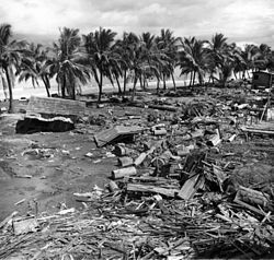
A massive tsunami devastated 700 kilometers of coastline bordering the Moro Gulf in the North Celebes Sea, resulting in destruction and death in the coastal communities of the Sulu Archipelago, southern Mindanao particularly the provinces of Sultan Kudarat and Sarangani (formerly part of South Cotabato), and in the Zamboanga Peninsula including Zamboanga City and Pagadian City.
Initially over 8,000 people were officially counted as killed or missing, 10,000 injured, and 90,000 homeless, making it one of the most devastating disasters in the history of the Philippine Islands.
[7] After the initial earthquake the people were unaware of the need to move to higher ground; when the tsunami hit it sucked most of the victims out to sea.